You are here: Home > Network List > TA - USArray Transportable Network (new EarthScope stations) Stations List
> Station B18K Kokolik River, AK, USA > Earthquake Result Viewer
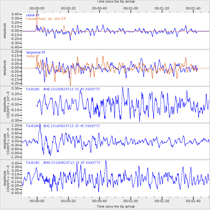
B18K Kokolik River, AK, USA - Earthquake Result Viewer
*The percent match for this event was below the threshold and hence no stack was calculated.
| Earthquake location: |
Santa Cruz Islands |
| Earthquake latitude/longitude: |
-11.4/166.3 |
| Earthquake time(UTC): |
2019/08/20 (232) 13:03:52 GMT |
| Earthquake Depth: |
37 km |
| Earthquake Magnitude: |
6.0 Mww |
| Earthquake Catalog/Contributor: |
NEIC PDE/us |
|
| Network: |
TA USArray Transportable Network (new EarthScope stations) |
| Station: |
B18K Kokolik River, AK, USA |
| Lat/Lon: |
69.36 N/161.80 W |
| Elevation: |
222 m |
|
| Distance: |
83.6 deg |
| Az: |
10.867 deg |
| Baz: |
211.434 deg |
| Ray Param: |
$rayparam |
*The percent match for this event was below the threshold and hence was not used in the summary stack. |
|
| Radial Match: |
67.68313 % |
| Radial Bump: |
400 |
| Transverse Match: |
69.67242 % |
| Transverse Bump: |
400 |
| SOD ConfigId: |
19053131 |
| Insert Time: |
2019-09-03 13:09:40.325 +0000 |
| GWidth: |
2.5 |
| Max Bumps: |
400 |
| Tol: |
0.001 |
|
Signal To Noise
| Channel | StoN | STA | LTA |
| TA:B18K: :BHZ:20190820T13:15:45.699977Z | 4.8676853 | 6.106327E-7 | 1.2544622E-7 |
| TA:B18K: :BHN:20190820T13:15:45.699977Z | 1.1987283 | 1.346675E-7 | 1.1234198E-7 |
| TA:B18K: :BHE:20190820T13:15:45.699977Z | 1.1526911 | 1.0747754E-7 | 9.324054E-8 |
| Arrivals |
| Ps | |
| PpPs | |
| PsPs/PpSs | |


