You are here: Home > Network List > TA - USArray Transportable Network (new EarthScope stations) Stations List
> Station H16K Elim, AK, USA > Earthquake Result Viewer
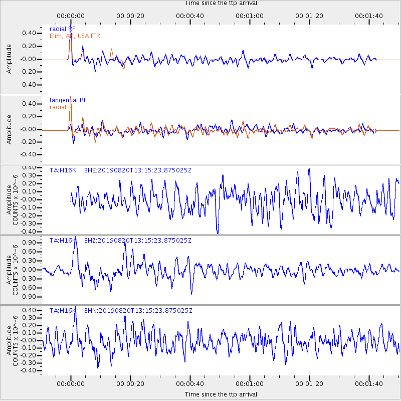
H16K Elim, AK, USA - Earthquake Result Viewer
*The percent match for this event was below the threshold and hence no stack was calculated.
| Earthquake location: |
Santa Cruz Islands |
| Earthquake latitude/longitude: |
-11.4/166.3 |
| Earthquake time(UTC): |
2019/08/20 (232) 13:03:52 GMT |
| Earthquake Depth: |
37 km |
| Earthquake Magnitude: |
6.0 Mww |
| Earthquake Catalog/Contributor: |
NEIC PDE/us |
|
| Network: |
TA USArray Transportable Network (new EarthScope stations) |
| Station: |
H16K Elim, AK, USA |
| Lat/Lon: |
64.64 N/162.24 W |
| Elevation: |
216 m |
|
| Distance: |
79.4 deg |
| Az: |
13.22 deg |
| Baz: |
211.38 deg |
| Ray Param: |
$rayparam |
*The percent match for this event was below the threshold and hence was not used in the summary stack. |
|
| Radial Match: |
75.80058 % |
| Radial Bump: |
400 |
| Transverse Match: |
69.52065 % |
| Transverse Bump: |
400 |
| SOD ConfigId: |
19053131 |
| Insert Time: |
2019-09-03 13:10:14.758 +0000 |
| GWidth: |
2.5 |
| Max Bumps: |
400 |
| Tol: |
0.001 |
|
Signal To Noise
| Channel | StoN | STA | LTA |
| TA:H16K: :BHZ:20190820T13:15:23.875025Z | 5.1453805 | 4.8073423E-7 | 9.343025E-8 |
| TA:H16K: :BHN:20190820T13:15:23.875025Z | 1.9642256 | 1.707104E-7 | 8.6909765E-8 |
| TA:H16K: :BHE:20190820T13:15:23.875025Z | 1.4765023 | 1.356595E-7 | 9.1878974E-8 |
| Arrivals |
| Ps | |
| PpPs | |
| PsPs/PpSs | |


