You are here: Home > Network List > TA - USArray Transportable Network (new EarthScope stations) Stations List
> Station M31M Drury Creek, Yukon, CA > Earthquake Result Viewer
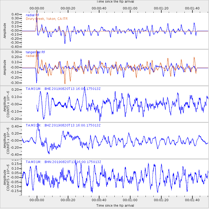
M31M Drury Creek, Yukon, CA - Earthquake Result Viewer
*The percent match for this event was below the threshold and hence no stack was calculated.
| Earthquake location: |
Santa Cruz Islands |
| Earthquake latitude/longitude: |
-11.4/166.3 |
| Earthquake time(UTC): |
2019/08/20 (232) 13:03:52 GMT |
| Earthquake Depth: |
37 km |
| Earthquake Magnitude: |
6.0 Mww |
| Earthquake Catalog/Contributor: |
NEIC PDE/us |
|
| Network: |
TA USArray Transportable Network (new EarthScope stations) |
| Station: |
M31M Drury Creek, Yukon, CA |
| Lat/Lon: |
62.20 N/134.39 W |
| Elevation: |
639 m |
|
| Distance: |
86.5 deg |
| Az: |
23.823 deg |
| Baz: |
237.667 deg |
| Ray Param: |
$rayparam |
*The percent match for this event was below the threshold and hence was not used in the summary stack. |
|
| Radial Match: |
52.109253 % |
| Radial Bump: |
400 |
| Transverse Match: |
57.69389 % |
| Transverse Bump: |
400 |
| SOD ConfigId: |
19053131 |
| Insert Time: |
2019-09-03 13:10:49.762 +0000 |
| GWidth: |
2.5 |
| Max Bumps: |
400 |
| Tol: |
0.001 |
|
Signal To Noise
| Channel | StoN | STA | LTA |
| TA:M31M: :BHZ:20190820T13:16:00.175013Z | 4.172403 | 2.2455691E-7 | 5.381957E-8 |
| TA:M31M: :BHN:20190820T13:16:00.175013Z | 1.7056705 | 6.263148E-8 | 3.6719566E-8 |
| TA:M31M: :BHE:20190820T13:16:00.175013Z | 1.339532 | 1.06114385E-7 | 7.921751E-8 |
| Arrivals |
| Ps | |
| PpPs | |
| PsPs/PpSs | |


