You are here: Home > Network List > UU - University of Utah Regional Network Stations List
> Station FORU South Mineral Mountains, UT, USA > Earthquake Result Viewer
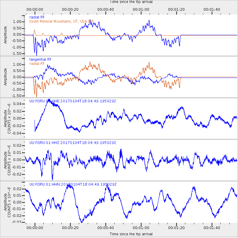
FORU South Mineral Mountains, UT, USA - Earthquake Result Viewer
*The percent match for this event was below the threshold and hence no stack was calculated.
| Earthquake location: |
Near East Coast Of Honshu, Japan |
| Earthquake latitude/longitude: |
37.1/141.3 |
| Earthquake time(UTC): |
2017/01/04 (004) 17:53:20 GMT |
| Earthquake Depth: |
10 km |
| Earthquake Magnitude: |
5.6 mb |
| Earthquake Catalog/Contributor: |
NEIC PDE/us |
|
| Network: |
UU University of Utah Regional Network |
| Station: |
FORU South Mineral Mountains, UT, USA |
| Lat/Lon: |
38.46 N/112.86 W |
| Elevation: |
1840 m |
|
| Distance: |
78.4 deg |
| Az: |
50.466 deg |
| Baz: |
308.27 deg |
| Ray Param: |
$rayparam |
*The percent match for this event was below the threshold and hence was not used in the summary stack. |
|
| Radial Match: |
63.375004 % |
| Radial Bump: |
400 |
| Transverse Match: |
47.272545 % |
| Transverse Bump: |
400 |
| SOD ConfigId: |
1943534 |
| Insert Time: |
2017-01-18 17:57:10.268 +0000 |
| GWidth: |
2.5 |
| Max Bumps: |
400 |
| Tol: |
0.001 |
|
Signal To Noise
| Channel | StoN | STA | LTA |
| UU:FORU:01:HHZ:20170104T18:04:49.195029Z | 1.4019089 | 7.509613E-9 | 5.3567053E-9 |
| UU:FORU:01:HHN:20170104T18:04:49.195029Z | 0.49531576 | 7.567566E-9 | 1.5278268E-8 |
| UU:FORU:01:HHE:20170104T18:04:49.195029Z | 0.79209477 | 2.2700785E-8 | 2.865918E-8 |
| Arrivals |
| Ps | |
| PpPs | |
| PsPs/PpSs | |


