You are here: Home > Network List > UU - University of Utah Regional Network Stations List
> Station KNB Kanab, UT, USA > Earthquake Result Viewer
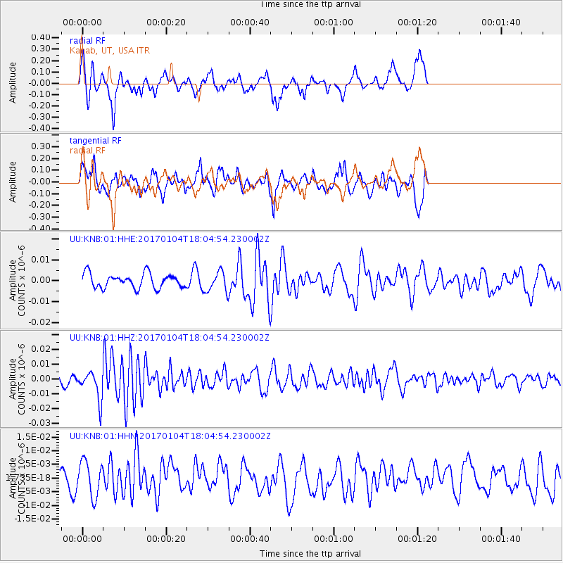
KNB Kanab, UT, USA - Earthquake Result Viewer
*The percent match for this event was below the threshold and hence no stack was calculated.
| Earthquake location: |
Near East Coast Of Honshu, Japan |
| Earthquake latitude/longitude: |
37.1/141.3 |
| Earthquake time(UTC): |
2017/01/04 (004) 17:53:20 GMT |
| Earthquake Depth: |
10 km |
| Earthquake Magnitude: |
5.6 mb |
| Earthquake Catalog/Contributor: |
NEIC PDE/us |
|
| Network: |
UU University of Utah Regional Network |
| Station: |
KNB Kanab, UT, USA |
| Lat/Lon: |
37.02 N/112.82 W |
| Elevation: |
1715 m |
|
| Distance: |
79.3 deg |
| Az: |
51.597 deg |
| Baz: |
308.513 deg |
| Ray Param: |
$rayparam |
*The percent match for this event was below the threshold and hence was not used in the summary stack. |
|
| Radial Match: |
58.98251 % |
| Radial Bump: |
293 |
| Transverse Match: |
57.77047 % |
| Transverse Bump: |
400 |
| SOD ConfigId: |
1943534 |
| Insert Time: |
2017-01-18 17:57:14.190 +0000 |
| GWidth: |
2.5 |
| Max Bumps: |
400 |
| Tol: |
0.001 |
|
Signal To Noise
| Channel | StoN | STA | LTA |
| UU:KNB:01:HHZ:20170104T18:04:54.230002Z | 2.401379 | 1.0048747E-8 | 4.1845736E-9 |
| UU:KNB:01:HHN:20170104T18:04:54.230002Z | 1.5330485 | 6.5670496E-9 | 4.283654E-9 |
| UU:KNB:01:HHE:20170104T18:04:54.230002Z | 1.4482499 | 4.9044053E-9 | 3.3864358E-9 |
| Arrivals |
| Ps | |
| PpPs | |
| PsPs/PpSs | |


