You are here: Home > Network List > TA - USArray Transportable Network (new EarthScope stations) Stations List
> Station G16K Koyuk River, AK, USA > Earthquake Result Viewer
G16K Koyuk River, AK, USA - Earthquake Result Viewer
*The percent match for this event was below the threshold and hence no stack was calculated.
| Earthquake location: |
Solomon Islands |
| Earthquake latitude/longitude: |
-6.1/154.7 |
| Earthquake time(UTC): |
2019/08/21 (233) 09:24:55 GMT |
| Earthquake Depth: |
72 km |
| Earthquake Magnitude: |
5.4 Mww |
| Earthquake Catalog/Contributor: |
NEIC PDE/us |
|
| Network: |
TA USArray Transportable Network (new EarthScope stations) |
| Station: |
G16K Koyuk River, AK, USA |
| Lat/Lon: |
65.39 N/162.35 W |
| Elevation: |
169 m |
|
| Distance: |
77.9 deg |
| Az: |
16.974 deg |
| Baz: |
223.899 deg |
| Ray Param: |
$rayparam |
*The percent match for this event was below the threshold and hence was not used in the summary stack. |
|
| Radial Match: |
51.105145 % |
| Radial Bump: |
400 |
| Transverse Match: |
49.410248 % |
| Transverse Bump: |
400 |
| SOD ConfigId: |
19053131 |
| Insert Time: |
2019-09-04 09:29:33.392 +0000 |
| GWidth: |
2.5 |
| Max Bumps: |
400 |
| Tol: |
0.001 |
|
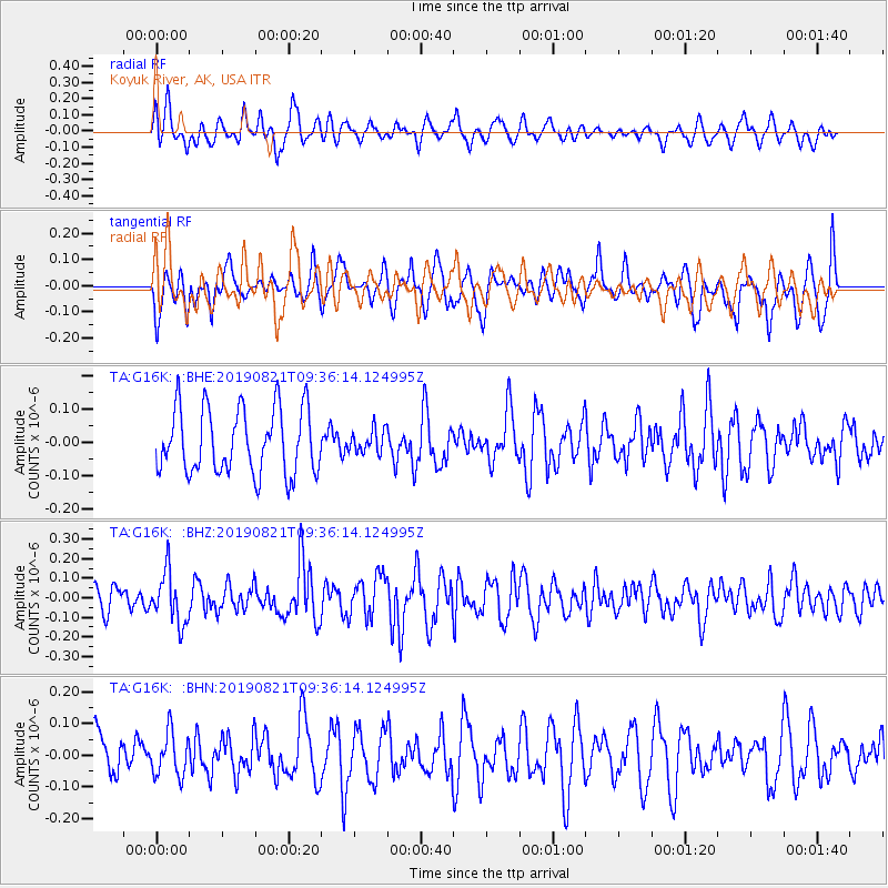
Signal To Noise
| Channel | StoN | STA | LTA |
| TA:G16K: :BHZ:20190821T09:36:14.124995Z | 1.7989017 | 1.312127E-7 | 7.294045E-8 |
| TA:G16K: :BHN:20190821T09:36:14.124995Z | 1.039149 | 6.830422E-8 | 6.5730916E-8 |
| TA:G16K: :BHE:20190821T09:36:14.124995Z | 0.36614603 | 3.5801502E-8 | 9.77793E-8 |
| Arrivals |
| Ps | |
| PpPs | |
| PsPs/PpSs | |


