
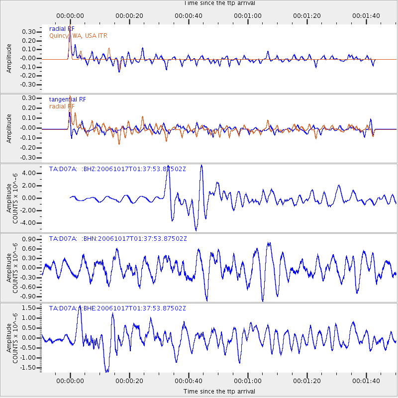
D07A Quincy, WA, USA - Earthquake Result Viewer
| ||||||||||||||||||
| ||||||||||||||||||
| ||||||||||||||||||
|
Signal To Noise
| Channel | StoN | STA | LTA |
| TA:D07A: :BHN:20061017T01:37:53.87502Z | 0.80750036 | 2.0949432E-7 | 2.5943558E-7 |
| TA:D07A: :BHE:20061017T01:37:53.87502Z | 3.203353 | 7.287412E-7 | 2.2749326E-7 |
| TA:D07A: :BHZ:20061017T01:37:53.87502Z | 7.558537 | 2.5008487E-6 | 3.3086414E-7 |
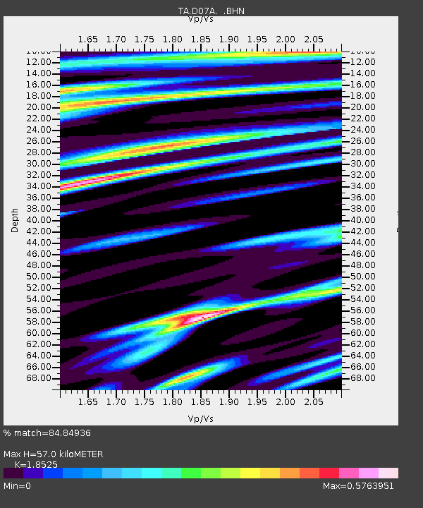
| Arrivals | |
| Ps | 7.7 SECOND |
| PpPs | 25 SECOND |
| PsPs/PpSs | 33 SECOND |

