You are here: Home > Network List > TS - TERRAscope (Southern California Seismic Network) Stations List
> Station MLAC Mammoth Lakes, California, USA > Earthquake Result Viewer
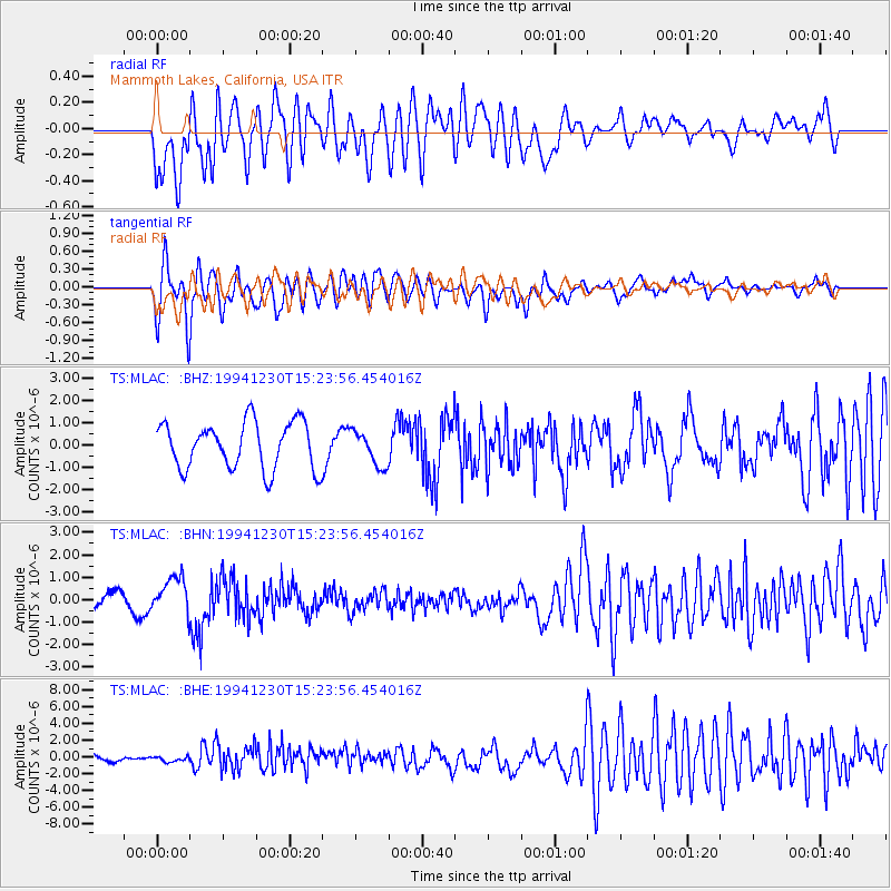
MLAC Mammoth Lakes, California, USA - Earthquake Result Viewer
*The percent match for this event was below the threshold and hence no stack was calculated.
| Earthquake location: |
Mariana Islands |
| Earthquake latitude/longitude: |
18.6/145.3 |
| Earthquake time(UTC): |
1994/12/30 (364) 15:12:26 GMT |
| Earthquake Depth: |
235 km |
| Earthquake Magnitude: |
5.6 MB, 5.8 UNKNOWN, 6.3 MW |
| Earthquake Catalog/Contributor: |
WHDF/NEIC |
|
| Network: |
TS TERRAscope (Southern California Seismic Network) |
| Station: |
MLAC Mammoth Lakes, California, USA |
| Lat/Lon: |
37.63 N/118.83 W |
| Elevation: |
2170 m |
|
| Distance: |
83.4 deg |
| Az: |
52.658 deg |
| Baz: |
288.241 deg |
| Ray Param: |
$rayparam |
*The percent match for this event was below the threshold and hence was not used in the summary stack. |
|
| Radial Match: |
63.225006 % |
| Radial Bump: |
400 |
| Transverse Match: |
58.83981 % |
| Transverse Bump: |
400 |
| SOD ConfigId: |
4480 |
| Insert Time: |
2010-02-26 14:26:14.247 +0000 |
| GWidth: |
2.5 |
| Max Bumps: |
400 |
| Tol: |
0.001 |
|
Signal To Noise
| Channel | StoN | STA | LTA |
| TS:MLAC: :BHN:19941230T15:23:56.454016Z | 1.5965638 | 8.1424906E-7 | 5.100009E-7 |
| TS:MLAC: :BHE:19941230T15:23:56.454016Z | 0.47707173 | 2.7465805E-7 | 5.7571646E-7 |
| TS:MLAC: :BHZ:19941230T15:23:56.454016Z | 0.73771834 | 7.7638964E-7 | 1.0524202E-6 |
| Arrivals |
| Ps | |
| PpPs | |
| PsPs/PpSs | |


