You are here: Home > Network List > AV - Alaska Volcano Observatory Stations List
> Station MAPS Pakushin Southeast, Makushin Volcano, Alaska > Earthquake Result Viewer
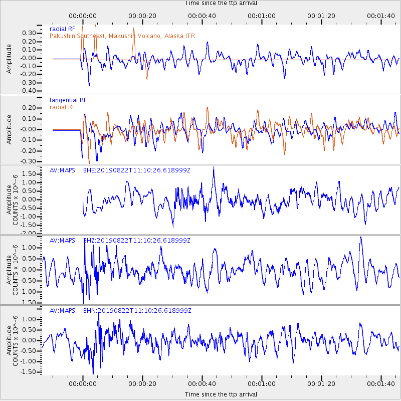
MAPS Pakushin Southeast, Makushin Volcano, Alaska - Earthquake Result Viewer
*The percent match for this event was below the threshold and hence no stack was calculated.
| Earthquake location: |
Mariana Islands |
| Earthquake latitude/longitude: |
17.6/145.5 |
| Earthquake time(UTC): |
2019/08/22 (234) 11:02:40 GMT |
| Earthquake Depth: |
512 km |
| Earthquake Magnitude: |
5.4 Mww |
| Earthquake Catalog/Contributor: |
NEIC PDE/us |
|
| Network: |
AV Alaska Volcano Observatory |
| Station: |
MAPS Pakushin Southeast, Makushin Volcano, Alaska |
| Lat/Lon: |
53.81 N/166.94 W |
| Elevation: |
333 m |
|
| Distance: |
51.4 deg |
| Az: |
34.055 deg |
| Baz: |
244.23 deg |
| Ray Param: |
$rayparam |
*The percent match for this event was below the threshold and hence was not used in the summary stack. |
|
| Radial Match: |
40.257397 % |
| Radial Bump: |
400 |
| Transverse Match: |
47.93907 % |
| Transverse Bump: |
400 |
| SOD ConfigId: |
19053131 |
| Insert Time: |
2019-09-05 11:05:31.462 +0000 |
| GWidth: |
2.5 |
| Max Bumps: |
400 |
| Tol: |
0.001 |
|
Signal To Noise
| Channel | StoN | STA | LTA |
| AV:MAPS: :BHZ:20190822T11:10:26.618999Z | 1.6683532 | 6.7339727E-7 | 4.0362994E-7 |
| AV:MAPS: :BHN:20190822T11:10:26.618999Z | 1.9890696 | 7.307442E-7 | 3.673799E-7 |
| AV:MAPS: :BHE:20190822T11:10:26.618999Z | 1.2601255 | 6.173202E-7 | 4.8988784E-7 |
| Arrivals |
| Ps | |
| PpPs | |
| PsPs/PpSs | |


