T13A Saint George, UT, USA - Earthquake Result Viewer
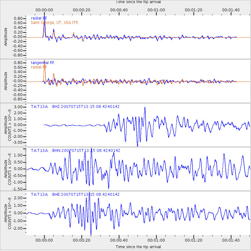
Earthquake location: Fox Islands, Aleutian Islands
Earthquake latitude/longitude: 52.5/-168.0
Earthquake time(UTC): 2007/07/15 (196) 13:08:00 GMT
Earthquake Depth: 10 km
Earthquake Magnitude: 5.8 MB, 5.9 MS, 6.1 MW, 6.0 MW
Earthquake Catalog/Contributor: WHDF/NEIC
Network: TA USArray Transportable Network (new EarthScope stations)
Station: T13A Saint George, UT, USA
Lat/Lon: 37.02 N/113.91 W
Elevation: 878 m
Distance: 40.4 deg
Az: 90.377 deg
Baz: 310.168 deg
Ray Param: 0.07440054
Estimated Moho Depth: 37.25 km
Estimated Crust Vp/Vs: 1.80
Assumed Crust Vp: 6.194 km/s
Estimated Crust Vs: 3.451 km/s
Estimated Crust Poisson's Ratio: 0.27
Radial Match: 94.866 %
Radial Bump: 329
Transverse Match: 85.58771 %
Transverse Bump: 400
SOD ConfigId: 2564
Insert Time: 2010-03-07 03:26:42.275 +0000
GWidth: 2.5
Max Bumps: 400
Tol: 0.001

Signal To Noise

ChannelStoNSTALTA
TA:T13A: :BHN:20070715T13:15:08.424014Z2.83880881.8983842E-76.687256E-8
TA:T13A: :BHE:20070715T13:15:08.424014Z3.52406262.4442994E-76.9360276E-8
TA:T13A: :BHZ:20070715T13:15:08.424014Z5.14175463.5402863E-76.885366E-8
Arrivals
Ps5.1 SECOND
PpPs16 SECOND
PsPs/PpSs21 SECOND