T13A Saint George, UT, USA - Earthquake Result Viewer
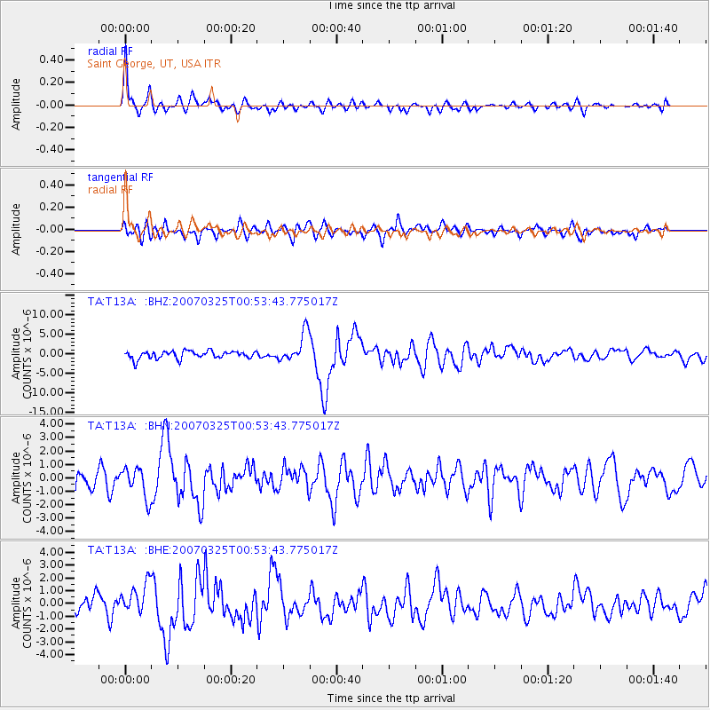
Earthquake location: Near West Coast Of Honshu, Japan
Earthquake latitude/longitude: 37.3/136.6
Earthquake time(UTC): 2007/03/25 (084) 00:41:57 GMT
Earthquake Depth: 8.0 km
Earthquake Magnitude: 6.1 MB, 6.8 MS, 6.7 MW, 6.6 MW
Earthquake Catalog/Contributor: WHDF/NEIC
Network: TA USArray Transportable Network (new EarthScope stations)
Station: T13A Saint George, UT, USA
Lat/Lon: 37.02 N/113.91 W
Elevation: 878 m
Distance: 81.4 deg
Az: 49.726 deg
Baz: 310.553 deg
Ray Param: 0.047597356
Estimated Moho Depth: 39.5 km
Estimated Crust Vp/Vs: 1.73
Assumed Crust Vp: 6.194 km/s
Estimated Crust Vs: 3.586 km/s
Estimated Crust Poisson's Ratio: 0.25
Radial Match: 88.42586 %
Radial Bump: 400
Transverse Match: 70.39182 %
Transverse Bump: 400
SOD ConfigId: 2564
Insert Time: 2010-03-07 03:27:01.761 +0000
GWidth: 2.5
Max Bumps: 400
Tol: 0.001

Signal To Noise

ChannelStoNSTALTA
TA:T13A: :BHN:20070325T00:53:43.775017Z2.1961511.1288615E-65.1401815E-7
TA:T13A: :BHE:20070325T00:53:43.775017Z1.66635571.1816708E-67.091347E-7
TA:T13A: :BHZ:20070325T00:53:43.775017Z3.9525813.893193E-69.849749E-7
Arrivals
Ps4.8 SECOND
PpPs17 SECOND
PsPs/PpSs22 SECOND