Q09A Carvers, NV, USA - Earthquake Result Viewer
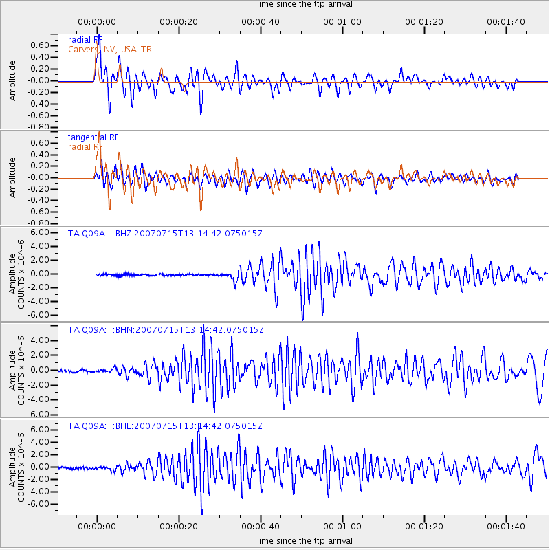
Earthquake location: Fox Islands, Aleutian Islands
Earthquake latitude/longitude: 52.5/-168.0
Earthquake time(UTC): 2007/07/15 (196) 13:08:00 GMT
Earthquake Depth: 10 km
Earthquake Magnitude: 5.8 MB, 5.9 MS, 6.1 MW, 6.0 MW
Earthquake Catalog/Contributor: WHDF/NEIC
Network: TA USArray Transportable Network (new EarthScope stations)
Station: Q09A Carvers, NV, USA
Lat/Lon: 38.83 N/117.18 W
Elevation: 1704 m
Distance: 37.3 deg
Az: 90.758 deg
Baz: 308.46 deg
Ray Param: 0.076216035
Estimated Moho Depth: 50.25 km
Estimated Crust Vp/Vs: 1.66
Assumed Crust Vp: 6.276 km/s
Estimated Crust Vs: 3.775 km/s
Estimated Crust Poisson's Ratio: 0.22
Radial Match: 90.32268 %
Radial Bump: 392
Transverse Match: 83.34051 %
Transverse Bump: 400
SOD ConfigId: 2564
Insert Time: 2010-03-07 03:27:51.220 +0000
GWidth: 2.5
Max Bumps: 400
Tol: 0.001

Signal To Noise

ChannelStoNSTALTA
TA:Q09A: :BHN:20070715T13:14:42.075015Z2.33950282.4674415E-71.0546863E-7
TA:Q09A: :BHE:20070715T13:14:42.075015Z1.60691382.8404838E-71.7676642E-7
TA:Q09A: :BHZ:20070715T13:14:42.075015Z6.56355866.426668E-79.791438E-8
Arrivals
Ps5.7 SECOND
PpPs20 SECOND
PsPs/PpSs25 SECOND