Q09A Carvers, NV, USA - Earthquake Result Viewer
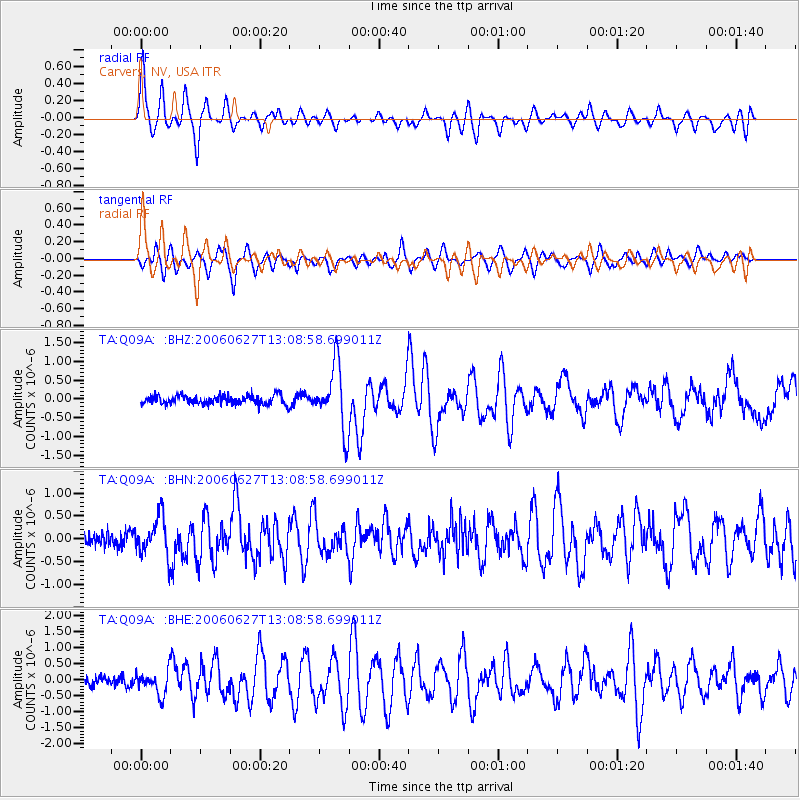
Earthquake location: Off Coast Of Chiapas, Mexico
Earthquake latitude/longitude: 15.0/-94.2
Earthquake time(UTC): 2006/06/27 (178) 13:03:12 GMT
Earthquake Depth: 29 km
Earthquake Magnitude: 5.4 MB, 5.5 MS, 5.8 MW, 5.8 MW
Earthquake Catalog/Contributor: WHDF/NEIC
Network: TA USArray Transportable Network (new EarthScope stations)
Station: Q09A Carvers, NV, USA
Lat/Lon: 38.83 N/117.18 W
Elevation: 1704 m
Distance: 31.2 deg
Az: 323.943 deg
Baz: 133.248 deg
Ray Param: 0.079098344
Estimated Moho Depth: 56.25 km
Estimated Crust Vp/Vs: 1.76
Assumed Crust Vp: 6.276 km/s
Estimated Crust Vs: 3.556 km/s
Estimated Crust Poisson's Ratio: 0.26
Radial Match: 86.451485 %
Radial Bump: 400
Transverse Match: 78.11683 %
Transverse Bump: 400
SOD ConfigId: 2665
Insert Time: 2010-03-07 03:28:25.395 +0000
GWidth: 2.5
Max Bumps: 400
Tol: 0.001

Signal To Noise

ChannelStoNSTALTA
TA:Q09A: :BHN:20060627T13:08:58.699011Z2.83261784.3113292E-71.52203E-7
TA:Q09A: :BHE:20060627T13:08:58.699011Z2.72527123.711322E-71.3618174E-7
TA:Q09A: :BHZ:20060627T13:08:58.699011Z7.2100658.4291725E-71.1690841E-7
Arrivals
Ps7.4 SECOND
PpPs23 SECOND
PsPs/PpSs30 SECOND