
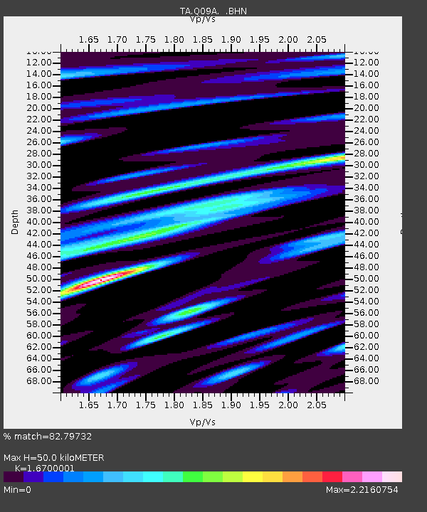
Q09A Carvers, NV, USA - Earthquake Result Viewer
| ||||||||||||||||||
| ||||||||||||||||||
| ||||||||||||||||||
|
Signal To Noise
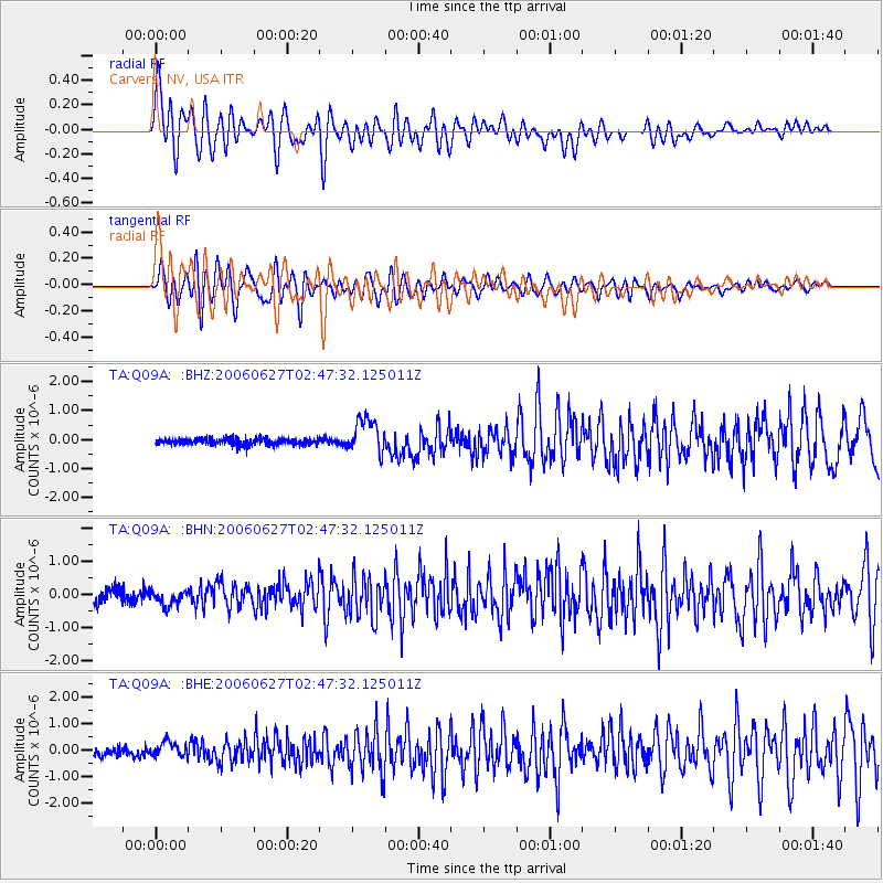
| Channel | StoN | STA | LTA |
| TA:Q09A: :BHN:20060627T02:47:32.125011Z | 1.1440212 | 2.5231432E-7 | 2.2055042E-7 |
| TA:Q09A: :BHE:20060627T02:47:32.125011Z | 1.75399 | 2.8876173E-7 | 1.6463135E-7 |
| TA:Q09A: :BHZ:20060627T02:47:32.125011Z | 5.4561257 | 6.0187597E-7 | 1.1031197E-7 |
| Arrivals | |
| Ps | 5.7 SECOND |
| PpPs | 20 SECOND |
| PsPs/PpSs | 26 SECOND |

