You are here: Home > Network List > CI - Caltech Regional Seismic Network Stations List
> Station MPM Manuel Prospect Mine, California, USA > Earthquake Result Viewer
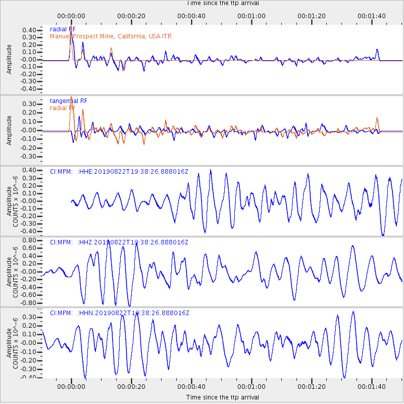
MPM Manuel Prospect Mine, California, USA - Earthquake Result Viewer
*The percent match for this event was below the threshold and hence no stack was calculated.
| Earthquake location: |
Fiji Islands Region |
| Earthquake latitude/longitude: |
-14.8/-177.3 |
| Earthquake time(UTC): |
2019/08/22 (234) 19:27:12 GMT |
| Earthquake Depth: |
10 km |
| Earthquake Magnitude: |
5.8 Mww |
| Earthquake Catalog/Contributor: |
NEIC PDE/us |
|
| Network: |
CI Caltech Regional Seismic Network |
| Station: |
MPM Manuel Prospect Mine, California, USA |
| Lat/Lon: |
36.06 N/117.49 W |
| Elevation: |
185 m |
|
| Distance: |
75.8 deg |
| Az: |
46.259 deg |
| Baz: |
239.591 deg |
| Ray Param: |
$rayparam |
*The percent match for this event was below the threshold and hence was not used in the summary stack. |
|
| Radial Match: |
79.72514 % |
| Radial Bump: |
377 |
| Transverse Match: |
73.31428 % |
| Transverse Bump: |
350 |
| SOD ConfigId: |
19053131 |
| Insert Time: |
2019-09-05 19:31:28.726 +0000 |
| GWidth: |
2.5 |
| Max Bumps: |
400 |
| Tol: |
0.001 |
|
Signal To Noise
| Channel | StoN | STA | LTA |
| CI:MPM: :HHZ:20190822T19:38:26.888016Z | 7.9273005 | 3.6648385E-7 | 4.62306E-8 |
| CI:MPM: :HHN:20190822T19:38:26.888016Z | 2.7127676 | 1.8521266E-7 | 6.8274424E-8 |
| CI:MPM: :HHE:20190822T19:38:26.888016Z | 1.7909527 | 1.1728788E-7 | 6.54891E-8 |
| Arrivals |
| Ps | |
| PpPs | |
| PsPs/PpSs | |


