T14A Hurricane, UT, USA - Earthquake Result Viewer
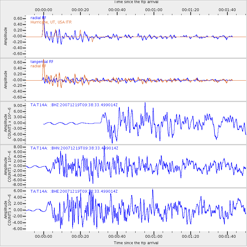
Earthquake location: Andreanof Islands, Aleutian Is.
Earthquake latitude/longitude: 51.4/-179.5
Earthquake time(UTC): 2007/12/19 (353) 09:30:27 GMT
Earthquake Depth: 29 km
Earthquake Magnitude: 6.4 MB, 7.1 MS, 7.1 MW, 7.0 MW
Earthquake Catalog/Contributor: WHDF/NEIC
Network: TA USArray Transportable Network (new EarthScope stations)
Station: T14A Hurricane, UT, USA
Lat/Lon: 37.06 N/113.08 W
Elevation: 1529 m
Distance: 48.1 deg
Az: 80.166 deg
Baz: 309.446 deg
Ray Param: 0.06952963
Estimated Moho Depth: 15.5 km
Estimated Crust Vp/Vs: 1.63
Assumed Crust Vp: 6.194 km/s
Estimated Crust Vs: 3.8 km/s
Estimated Crust Poisson's Ratio: 0.20
Radial Match: 93.86387 %
Radial Bump: 400
Transverse Match: 76.973595 %
Transverse Bump: 400
SOD ConfigId: 2564
Insert Time: 2010-03-07 03:30:08.233 +0000
GWidth: 2.5
Max Bumps: 400
Tol: 0.001

Signal To Noise

ChannelStoNSTALTA
TA:T14A: :BHN:20071219T09:38:33.499014Z4.71434071.2042512E-62.5544426E-7
TA:T14A: :BHE:20071219T09:38:33.499014Z5.70765261.4909076E-62.6121205E-7
TA:T14A: :BHZ:20071219T09:38:33.499014Z7.80864142.744645E-63.5148813E-7
Arrivals
Ps1.7 SECOND
PpPs6.2 SECOND
PsPs/PpSs7.9 SECOND