You are here: Home > Network List > TS - TERRAscope (Southern California Seismic Network) Stations List
> Station MLAC Mammoth Lakes, California, USA > Earthquake Result Viewer
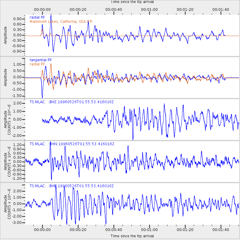
MLAC Mammoth Lakes, California, USA - Earthquake Result Viewer
*The percent match for this event was below the threshold and hence no stack was calculated.
| Earthquake location: |
Southeast Of Loyalty Islands |
| Earthquake latitude/longitude: |
-22.2/171.5 |
| Earthquake time(UTC): |
1996/05/26 (147) 01:43:44 GMT |
| Earthquake Depth: |
108 km |
| Earthquake Magnitude: |
5.6 MB, 6.1 UNKNOWN, 6.1 MW |
| Earthquake Catalog/Contributor: |
WHDF/NEIC |
|
| Network: |
TS TERRAscope (Southern California Seismic Network) |
| Station: |
MLAC Mammoth Lakes, California, USA |
| Lat/Lon: |
37.63 N/118.83 W |
| Elevation: |
2170 m |
|
| Distance: |
88.4 deg |
| Az: |
48.147 deg |
| Baz: |
240.402 deg |
| Ray Param: |
$rayparam |
*The percent match for this event was below the threshold and hence was not used in the summary stack. |
|
| Radial Match: |
62.400375 % |
| Radial Bump: |
400 |
| Transverse Match: |
51.93143 % |
| Transverse Bump: |
400 |
| SOD ConfigId: |
4480 |
| Insert Time: |
2010-02-26 14:26:31.785 +0000 |
| GWidth: |
2.5 |
| Max Bumps: |
400 |
| Tol: |
0.001 |
|
Signal To Noise
| Channel | StoN | STA | LTA |
| TS:MLAC: :BHN:19960526T01:55:53.416016Z | 3.427915 | 4.228613E-7 | 1.2335815E-7 |
| TS:MLAC: :BHE:19960526T01:55:53.416016Z | 0.92412156 | 2.9557728E-7 | 3.1984678E-7 |
| TS:MLAC: :BHZ:19960526T01:55:53.416016Z | 1.1873932 | 2.644831E-7 | 2.2274264E-7 |
| Arrivals |
| Ps | |
| PpPs | |
| PsPs/PpSs | |


