
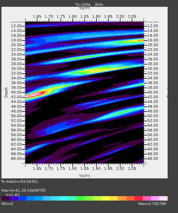
Q08A Gabbs, NV, USA - Earthquake Result Viewer
| ||||||||||||||||||
| ||||||||||||||||||
| ||||||||||||||||||
|
Signal To Noise
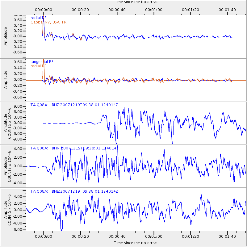
| Channel | StoN | STA | LTA |
| TA:Q08A: :BHN:20071219T09:38:01.124014Z | 5.6504536 | 8.3832424E-7 | 1.4836405E-7 |
| TA:Q08A: :BHE:20071219T09:38:01.124014Z | 1.9158555 | 1.1599021E-6 | 6.0542254E-7 |
| TA:Q08A: :BHZ:20071219T09:38:01.124014Z | 13.454334 | 2.7616231E-6 | 2.05259E-7 |
| Arrivals | |
| Ps | 4.4 SECOND |
| PpPs | 16 SECOND |
| PsPs/PpSs | 20 SECOND |

