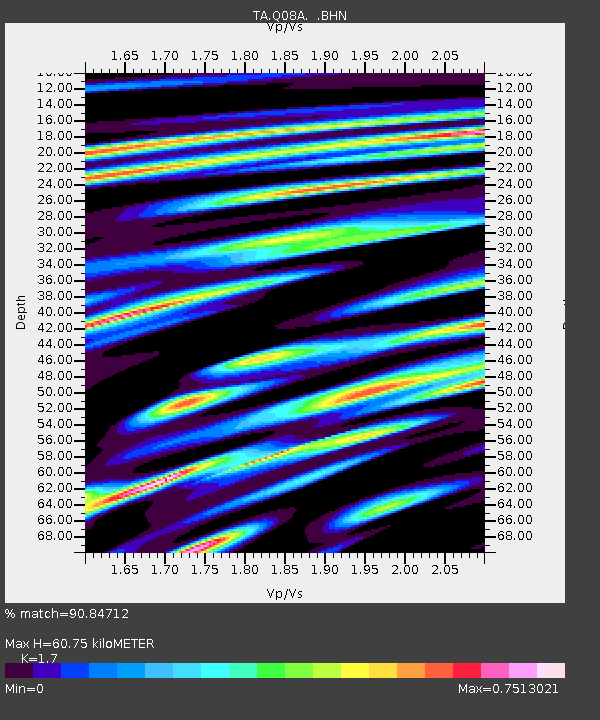
Q08A Gabbs, NV, USA - Earthquake Result Viewer
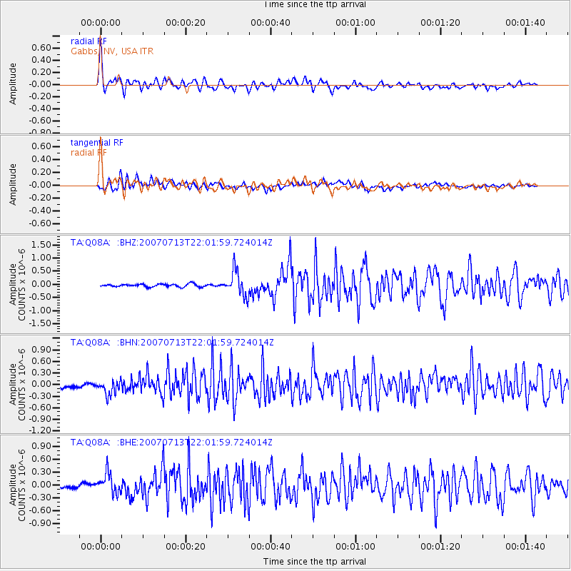
Earthquake location: Andreanof Islands, Aleutian Is.
Earthquake latitude/longitude: 51.8/-176.3
Earthquake time(UTC): 2007/07/13 (194) 21:54:43 GMT
Earthquake Depth: 35 km
Earthquake Magnitude: 5.7 MB, 5.6 MS, 6.0 MW, 5.9 MW
Earthquake Catalog/Contributor: WHDF/NEIC
Network: TA USArray Transportable Network (new EarthScope stations)
Station: Q08A Gabbs, NV, USA
Lat/Lon: 38.86 N/117.93 W
Elevation: 1412 m
Distance: 41.9 deg
Az: 84.294 deg
Baz: 307.742 deg
Ray Param: 0.07342006
Estimated Moho Depth: 60.75 km
Estimated Crust Vp/Vs: 1.70
Assumed Crust Vp: 6.276 km/s
Estimated Crust Vs: 3.692 km/s
Estimated Crust Poisson's Ratio: 0.24
Radial Match: 90.84712 %
Radial Bump: 400
Transverse Match: 80.06266 %
Transverse Bump: 400
SOD ConfigId: 2564
Insert Time: 2010-03-07 03:32:02.492 +0000
GWidth: 2.5
Max Bumps: 400
Tol: 0.001

Signal To Noise

ChannelStoNSTALTA
TA:Q08A: :BHN:20070713T22:01:59.724014Z3.17010712.013485E-76.3514726E-8
TA:Q08A: :BHE:20070713T22:01:59.724014Z3.2007312.3435993E-77.322075E-8
TA:Q08A: :BHZ:20070713T22:01:59.724014Z9.0153794.827849E-75.3551265E-8
Arrivals
Ps7.2 SECOND
PpPs24 SECOND
PsPs/PpSs32 SECOND