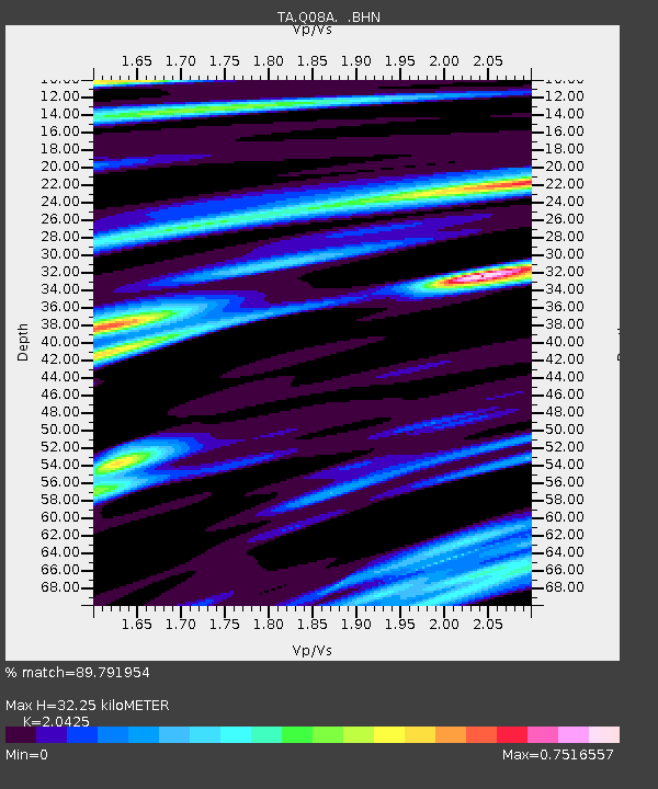
Q08A Gabbs, NV, USA - Earthquake Result Viewer
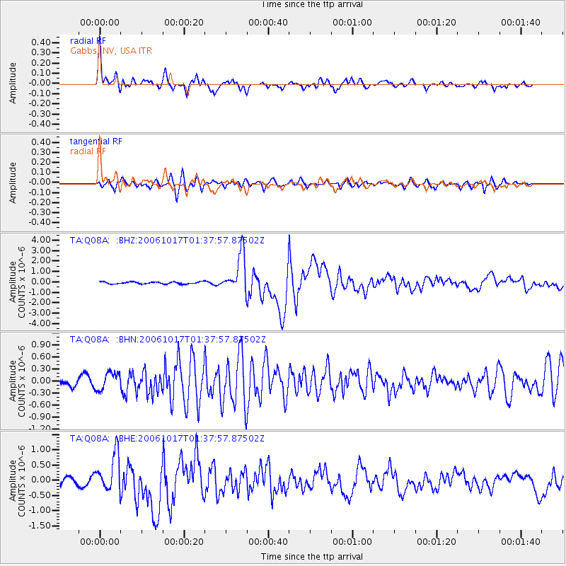
Earthquake location: New Britain Region, P.N.G.
Earthquake latitude/longitude: -5.9/151.0
Earthquake time(UTC): 2006/10/17 (290) 01:25:12 GMT
Earthquake Depth: 32 km
Earthquake Magnitude: 6.4 MB, 6.9 MS, 6.7 MW, 6.6 MW
Earthquake Catalog/Contributor: WHDF/NEIC
Network: TA USArray Transportable Network (new EarthScope stations)
Station: Q08A Gabbs, NV, USA
Lat/Lon: 38.86 N/117.93 W
Elevation: 1412 m
Distance: 94.5 deg
Az: 51.535 deg
Baz: 266.107 deg
Ray Param: 0.041018516
Estimated Moho Depth: 32.25 km
Estimated Crust Vp/Vs: 2.04
Assumed Crust Vp: 6.276 km/s
Estimated Crust Vs: 3.073 km/s
Estimated Crust Poisson's Ratio: 0.34
Radial Match: 89.791954 %
Radial Bump: 400
Transverse Match: 82.260506 %
Transverse Bump: 400
SOD ConfigId: 2665
Insert Time: 2010-03-07 03:32:35.159 +0000
GWidth: 2.5
Max Bumps: 400
Tol: 0.001

Signal To Noise

ChannelStoNSTALTA
TA:Q08A: :BHN:20061017T01:37:57.87502Z1.70753842.1364177E-71.2511681E-7
TA:Q08A: :BHE:20061017T01:37:57.87502Z3.7410616.167168E-71.6485077E-7
TA:Q08A: :BHZ:20061017T01:37:57.87502Z19.7436221.8893599E-69.56947E-8
Arrivals
Ps5.4 SECOND
PpPs15 SECOND
PsPs/PpSs21 SECOND