Q08A Gabbs, NV, USA - Earthquake Result Viewer
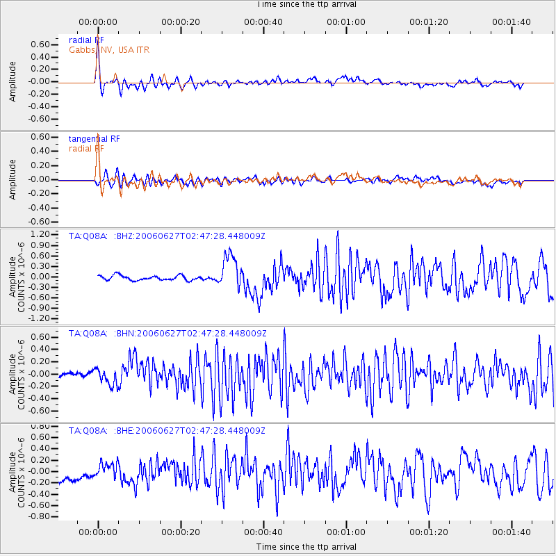
Earthquake location: Rat Islands, Aleutian Islands
Earthquake latitude/longitude: 52.2/176.2
Earthquake time(UTC): 2006/06/27 (178) 02:39:35 GMT
Earthquake Depth: 34 km
Earthquake Magnitude: 5.6 MB, 6.0 MS, 6.2 MW, 6.2 MW
Earthquake Catalog/Contributor: WHDF/NEIC
Network: TA USArray Transportable Network (new EarthScope stations)
Station: Q08A Gabbs, NV, USA
Lat/Lon: 38.86 N/117.93 W
Elevation: 1412 m
Distance: 46.5 deg
Az: 79.418 deg
Baz: 309.209 deg
Ray Param: 0.07056444
Estimated Moho Depth: 31.0 km
Estimated Crust Vp/Vs: 1.82
Assumed Crust Vp: 6.276 km/s
Estimated Crust Vs: 3.448 km/s
Estimated Crust Poisson's Ratio: 0.28
Radial Match: 83.569 %
Radial Bump: 400
Transverse Match: 69.58907 %
Transverse Bump: 400
SOD ConfigId: 2665
Insert Time: 2010-03-07 03:32:54.969 +0000
GWidth: 2.5
Max Bumps: 400
Tol: 0.001

Signal To Noise

ChannelStoNSTALTA
TA:Q08A: :BHN:20060627T02:47:28.448009Z1.32756541.2461082E-79.386416E-8
TA:Q08A: :BHE:20060627T02:47:28.448009Z0.933276061.2365462E-71.324952E-7
TA:Q08A: :BHZ:20060627T02:47:28.448009Z7.3545714.924917E-76.696403E-8
Arrivals
Ps4.3 SECOND
PpPs13 SECOND
PsPs/PpSs17 SECOND