You are here: Home > Network List > G - GEOSCOPE Stations List
> Station MPG Montagne des Peres, French Guyana > Earthquake Result Viewer
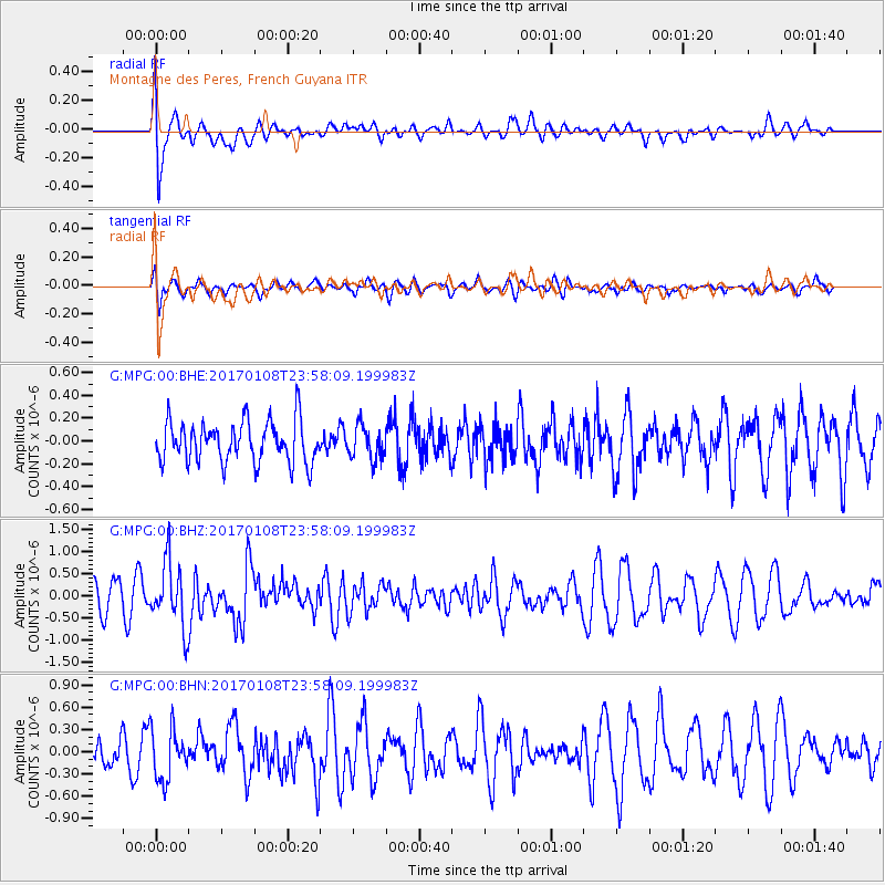
MPG Montagne des Peres, French Guyana - Earthquake Result Viewer
*The percent match for this event was below the threshold and hence no stack was calculated.
| Earthquake location: |
Queen Elizabeth Islands, Canada |
| Earthquake latitude/longitude: |
74.3/-92.3 |
| Earthquake time(UTC): |
2017/01/08 (008) 23:47:12 GMT |
| Earthquake Depth: |
19 km |
| Earthquake Magnitude: |
5.8 Mwp |
| Earthquake Catalog/Contributor: |
NEIC PDE/us |
|
| Network: |
G GEOSCOPE |
| Station: |
MPG Montagne des Peres, French Guyana |
| Lat/Lon: |
5.11 N/52.64 W |
| Elevation: |
147 m |
|
| Distance: |
72.9 deg |
| Az: |
138.312 deg |
| Baz: |
349.539 deg |
| Ray Param: |
$rayparam |
*The percent match for this event was below the threshold and hence was not used in the summary stack. |
|
| Radial Match: |
67.795555 % |
| Radial Bump: |
400 |
| Transverse Match: |
57.79529 % |
| Transverse Bump: |
400 |
| SOD ConfigId: |
1943534 |
| Insert Time: |
2017-01-22 23:49:44.388 +0000 |
| GWidth: |
2.5 |
| Max Bumps: |
400 |
| Tol: |
0.001 |
|
Signal To Noise
| Channel | StoN | STA | LTA |
| G:MPG:00:BHZ:20170108T23:58:09.199983Z | 1.9135381 | 7.284122E-7 | 3.806625E-7 |
| G:MPG:00:BHN:20170108T23:58:09.199983Z | 1.1496953 | 3.4519275E-7 | 3.0024717E-7 |
| G:MPG:00:BHE:20170108T23:58:09.199983Z | 0.8110443 | 1.4524898E-7 | 1.7908883E-7 |
| Arrivals |
| Ps | |
| PpPs | |
| PsPs/PpSs | |


