I08A Drewsey, OR, USA - Earthquake Result Viewer
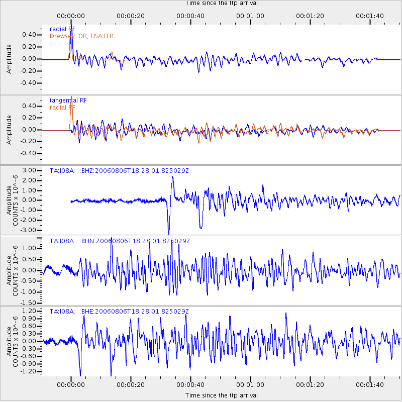
Earthquake location: Bonin Islands, Japan Region
Earthquake latitude/longitude: 26.1/144.0
Earthquake time(UTC): 2006/08/06 (218) 18:16:40 GMT
Earthquake Depth: 23 km
Earthquake Magnitude: 6.0 MB, 5.6 MS, 5.8 MW, 5.8 MW
Earthquake Catalog/Contributor: WHDF/NEIC
Network: TA USArray Transportable Network (new EarthScope stations)
Station: I08A Drewsey, OR, USA
Lat/Lon: 43.91 N/118.57 W
Elevation: 1189 m
Distance: 77.4 deg
Az: 47.262 deg
Baz: 293.99 deg
Ray Param: 0.050344307
Estimated Moho Depth: 33.0 km
Estimated Crust Vp/Vs: 1.64
Assumed Crust Vp: 6.279 km/s
Estimated Crust Vs: 3.817 km/s
Estimated Crust Poisson's Ratio: 0.21
Radial Match: 89.886856 %
Radial Bump: 400
Transverse Match: 77.155365 %
Transverse Bump: 400
SOD ConfigId: 2665
Insert Time: 2010-03-07 03:36:07.513 +0000
GWidth: 2.5
Max Bumps: 400
Tol: 0.001

Signal To Noise

ChannelStoNSTALTA
TA:I08A: :BHN:20060806T18:28:01.825029Z3.00307662.8223945E-79.398343E-8
TA:I08A: :BHE:20060806T18:28:01.825029Z6.53716375.1122225E-77.820246E-8
TA:I08A: :BHZ:20060806T18:28:01.825029Z14.3637291.2906189E-68.985264E-8
Arrivals
Ps3.5 SECOND
PpPs13 SECOND
PsPs/PpSs17 SECOND