You are here: Home > Network List > UW - Pacific Northwest Regional Seismic Network Stations List
> Station LEBA Lebam, WA, USA > Earthquake Result Viewer
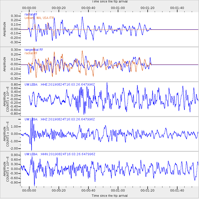
LEBA Lebam, WA, USA - Earthquake Result Viewer
*The percent match for this event was below the threshold and hence no stack was calculated.
| Earthquake location: |
Vanuatu Islands |
| Earthquake latitude/longitude: |
-14.3/167.2 |
| Earthquake time(UTC): |
2019/08/24 (236) 15:51:27 GMT |
| Earthquake Depth: |
115 km |
| Earthquake Magnitude: |
6.0 Mww |
| Earthquake Catalog/Contributor: |
NEIC PDE/us |
|
| Network: |
UW Pacific Northwest Regional Seismic Network |
| Station: |
LEBA Lebam, WA, USA |
| Lat/Lon: |
46.55 N/123.56 W |
| Elevation: |
73 m |
|
| Distance: |
86.6 deg |
| Az: |
40.287 deg |
| Baz: |
245.245 deg |
| Ray Param: |
$rayparam |
*The percent match for this event was below the threshold and hence was not used in the summary stack. |
|
| Radial Match: |
60.375877 % |
| Radial Bump: |
400 |
| Transverse Match: |
41.99273 % |
| Transverse Bump: |
400 |
| SOD ConfigId: |
19053131 |
| Insert Time: |
2019-09-07 16:03:31.228 +0000 |
| GWidth: |
2.5 |
| Max Bumps: |
400 |
| Tol: |
0.001 |
|
Signal To Noise
| Channel | StoN | STA | LTA |
| UW:LEBA: :HHZ:20190824T16:03:26.647996Z | 6.7238297 | 9.3428247E-7 | 1.3895094E-7 |
| UW:LEBA: :HHN:20190824T16:03:26.647996Z | 2.4486961 | 4.5999042E-7 | 1.8785117E-7 |
| UW:LEBA: :HHE:20190824T16:03:26.647996Z | 1.6613473 | 3.0367886E-7 | 1.8279071E-7 |
| Arrivals |
| Ps | |
| PpPs | |
| PsPs/PpSs | |


