You are here: Home > Network List > TS - TERRAscope (Southern California Seismic Network) Stations List
> Station MLAC Mammoth Lakes, California, USA > Earthquake Result Viewer
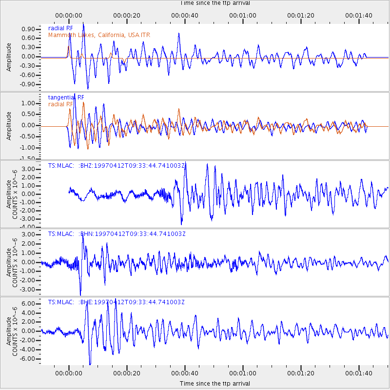
MLAC Mammoth Lakes, California, USA - Earthquake Result Viewer
*The percent match for this event was below the threshold and hence no stack was calculated.
| Earthquake location: |
Kermadec Islands Region |
| Earthquake latitude/longitude: |
-28.2/-178.4 |
| Earthquake time(UTC): |
1997/04/12 (102) 09:21:56 GMT |
| Earthquake Depth: |
184 km |
| Earthquake Magnitude: |
5.8 MB, 6.0 UNKNOWN, 6.0 MW |
| Earthquake Catalog/Contributor: |
WHDF/NEIC |
|
| Network: |
TS TERRAscope (Southern California Seismic Network) |
| Station: |
MLAC Mammoth Lakes, California, USA |
| Lat/Lon: |
37.63 N/118.83 W |
| Elevation: |
2170 m |
|
| Distance: |
86.0 deg |
| Az: |
43.314 deg |
| Baz: |
229.714 deg |
| Ray Param: |
$rayparam |
*The percent match for this event was below the threshold and hence was not used in the summary stack. |
|
| Radial Match: |
68.4303 % |
| Radial Bump: |
400 |
| Transverse Match: |
74.14528 % |
| Transverse Bump: |
400 |
| SOD ConfigId: |
4480 |
| Insert Time: |
2010-02-26 14:26:56.834 +0000 |
| GWidth: |
2.5 |
| Max Bumps: |
400 |
| Tol: |
0.001 |
|
Signal To Noise
| Channel | StoN | STA | LTA |
| TS:MLAC: :BHN:19970412T09:33:44.741003Z | 5.6552453 | 1.2268899E-6 | 2.1694724E-7 |
| TS:MLAC: :BHE:19970412T09:33:44.741003Z | 1.9424294 | 7.258364E-7 | 3.7367454E-7 |
| TS:MLAC: :BHZ:19970412T09:33:44.741003Z | 1.0963486 | 4.1380997E-7 | 3.7744377E-7 |
| Arrivals |
| Ps | |
| PpPs | |
| PsPs/PpSs | |


