You are here: Home > Network List > US - United States National Seismic Network Stations List
> Station DUG Dugway, Tooele County, Utah, USA > Earthquake Result Viewer
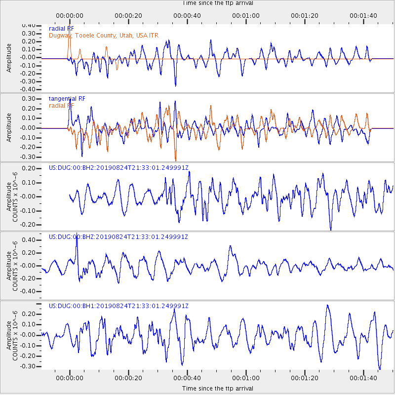
DUG Dugway, Tooele County, Utah, USA - Earthquake Result Viewer
*The percent match for this event was below the threshold and hence no stack was calculated.
| Earthquake location: |
Tonga Islands |
| Earthquake latitude/longitude: |
-20.2/-175.6 |
| Earthquake time(UTC): |
2019/08/24 (236) 21:21:27 GMT |
| Earthquake Depth: |
215 km |
| Earthquake Magnitude: |
5.5 Mww |
| Earthquake Catalog/Contributor: |
NEIC PDE/us |
|
| Network: |
US United States National Seismic Network |
| Station: |
DUG Dugway, Tooele County, Utah, USA |
| Lat/Lon: |
40.19 N/112.81 W |
| Elevation: |
1477 m |
|
| Distance: |
83.8 deg |
| Az: |
43.267 deg |
| Baz: |
237.194 deg |
| Ray Param: |
$rayparam |
*The percent match for this event was below the threshold and hence was not used in the summary stack. |
|
| Radial Match: |
54.75886 % |
| Radial Bump: |
400 |
| Transverse Match: |
65.067184 % |
| Transverse Bump: |
400 |
| SOD ConfigId: |
19053131 |
| Insert Time: |
2019-09-07 23:32:12.897 +0000 |
| GWidth: |
2.5 |
| Max Bumps: |
400 |
| Tol: |
0.001 |
|
Signal To Noise
| Channel | StoN | STA | LTA |
| US:DUG:00:BHZ:20190824T21:33:01.249991Z | 2.8671622 | 1.7220832E-7 | 6.006229E-8 |
| US:DUG:00:BH1:20190824T21:33:01.249991Z | 1.4491601 | 8.063834E-8 | 5.564488E-8 |
| US:DUG:00:BH2:20190824T21:33:01.249991Z | 0.8469306 | 4.9282658E-8 | 5.8189723E-8 |
| Arrivals |
| Ps | |
| PpPs | |
| PsPs/PpSs | |


