You are here: Home > Network List > UW - Pacific Northwest Regional Seismic Network Stations List
> Station UMAT Pilot Rock, OR, USA > Earthquake Result Viewer
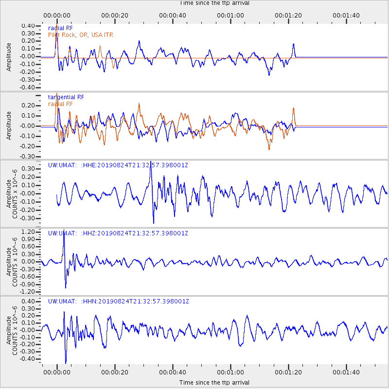
UMAT Pilot Rock, OR, USA - Earthquake Result Viewer
*The percent match for this event was below the threshold and hence no stack was calculated.
| Earthquake location: |
Tonga Islands |
| Earthquake latitude/longitude: |
-20.2/-175.6 |
| Earthquake time(UTC): |
2019/08/24 (236) 21:21:27 GMT |
| Earthquake Depth: |
215 km |
| Earthquake Magnitude: |
5.5 Mww |
| Earthquake Catalog/Contributor: |
NEIC PDE/us |
|
| Network: |
UW Pacific Northwest Regional Seismic Network |
| Station: |
UMAT Pilot Rock, OR, USA |
| Lat/Lon: |
45.29 N/118.96 W |
| Elevation: |
1318 m |
|
| Distance: |
83.0 deg |
| Az: |
36.455 deg |
| Baz: |
232.249 deg |
| Ray Param: |
$rayparam |
*The percent match for this event was below the threshold and hence was not used in the summary stack. |
|
| Radial Match: |
65.7846 % |
| Radial Bump: |
400 |
| Transverse Match: |
47.10854 % |
| Transverse Bump: |
400 |
| SOD ConfigId: |
19053131 |
| Insert Time: |
2019-09-07 23:32:57.796 +0000 |
| GWidth: |
2.5 |
| Max Bumps: |
400 |
| Tol: |
0.001 |
|
Signal To Noise
| Channel | StoN | STA | LTA |
| UW:UMAT: :HHZ:20190824T21:32:57.398001Z | 3.7073328 | 4.255145E-7 | 1.1477645E-7 |
| UW:UMAT: :HHN:20190824T21:32:57.398001Z | 2.8976336 | 1.4587961E-7 | 5.0344397E-8 |
| UW:UMAT: :HHE:20190824T21:32:57.398001Z | 2.2418222 | 1.6211385E-7 | 7.231343E-8 |
| Arrivals |
| Ps | |
| PpPs | |
| PsPs/PpSs | |


