You are here: Home > Network List > TA - USArray Transportable Network (new EarthScope stations) Stations List
> Station J11A Camas Ranch, Mayfield, ID, USA > Earthquake Result Viewer
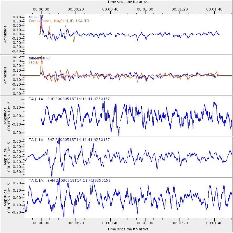
J11A Camas Ranch, Mayfield, ID, USA - Earthquake Result Viewer
*The percent match for this event was below the threshold and hence no stack was calculated.
| Earthquake location: |
Near Coast Of Peru |
| Earthquake latitude/longitude: |
-15.7/-74.8 |
| Earthquake time(UTC): |
2009/05/18 (138) 14:01:04 GMT |
| Earthquake Depth: |
23 km |
| Earthquake Magnitude: |
5.5 MS, 5.3 MB, 5.8 MW, 5.8 MW |
| Earthquake Catalog/Contributor: |
WHDF/NEIC |
|
| Network: |
TA USArray Transportable Network (new EarthScope stations) |
| Station: |
J11A Camas Ranch, Mayfield, ID, USA |
| Lat/Lon: |
43.42 N/115.83 W |
| Elevation: |
1302 m |
|
| Distance: |
69.7 deg |
| Az: |
329.371 deg |
| Baz: |
137.659 deg |
| Ray Param: |
$rayparam |
*The percent match for this event was below the threshold and hence was not used in the summary stack. |
|
| Radial Match: |
75.52858 % |
| Radial Bump: |
400 |
| Transverse Match: |
51.282833 % |
| Transverse Bump: |
400 |
| SOD ConfigId: |
2760 |
| Insert Time: |
2010-03-07 03:42:24.375 +0000 |
| GWidth: |
2.5 |
| Max Bumps: |
400 |
| Tol: |
0.001 |
|
Signal To Noise
| Channel | StoN | STA | LTA |
| TA:J11A: :BHZ:20090518T14:11:41.925015Z | 1.7488612 | 1.2524097E-7 | 7.1612874E-8 |
| TA:J11A: :BHN:20090518T14:11:41.925015Z | 1.0433836 | 6.447112E-8 | 6.179043E-8 |
| TA:J11A: :BHE:20090518T14:11:41.925015Z | 0.9105658 | 6.200499E-8 | 6.809502E-8 |
| Arrivals |
| Ps | |
| PpPs | |
| PsPs/PpSs | |


