You are here: Home > Network List > PF - Volcanologic Network of Piton de Fournaise-OVPF Stations List
> Station HIM cratere Himiltrude > Earthquake Result Viewer
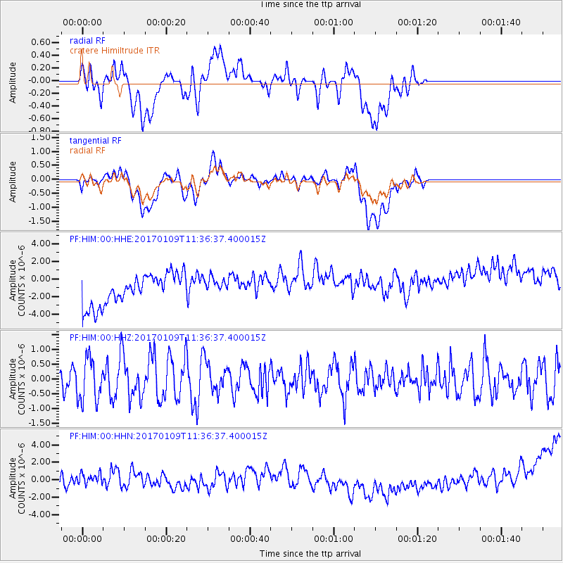
HIM cratere Himiltrude - Earthquake Result Viewer
*The percent match for this event was below the threshold and hence no stack was calculated.
| Earthquake location: |
Southern Sumatra, Indonesia |
| Earthquake latitude/longitude: |
-1.6/100.3 |
| Earthquake time(UTC): |
2017/01/09 (009) 11:28:38 GMT |
| Earthquake Depth: |
64 km |
| Earthquake Magnitude: |
5.5 mb |
| Earthquake Catalog/Contributor: |
NEIC PDE/us |
|
| Network: |
PF Volcanologic Network of Piton de Fournaise-OVPF |
| Station: |
HIM cratere Himiltrude |
| Lat/Lon: |
21.21 S/55.72 E |
| Elevation: |
1958 m |
|
| Distance: |
47.6 deg |
| Az: |
242.543 deg |
| Baz: |
71.919 deg |
| Ray Param: |
$rayparam |
*The percent match for this event was below the threshold and hence was not used in the summary stack. |
|
| Radial Match: |
14.088614 % |
| Radial Bump: |
400 |
| Transverse Match: |
8.621958 % |
| Transverse Bump: |
400 |
| SOD ConfigId: |
1943534 |
| Insert Time: |
2017-01-23 11:30:23.507 +0000 |
| GWidth: |
2.5 |
| Max Bumps: |
400 |
| Tol: |
0.001 |
|
Signal To Noise
| Channel | StoN | STA | LTA |
| PF:HIM:00:HHZ:20170109T11:36:37.400015Z | 1.3796992 | 7.3652274E-7 | 5.338285E-7 |
| PF:HIM:00:HHN:20170109T11:36:37.400015Z | 0.64957094 | 1.1990171E-6 | 1.8458602E-6 |
| PF:HIM:00:HHE:20170109T11:36:37.400015Z | 0.60032785 | 1.0364216E-6 | 1.726426E-6 |
| Arrivals |
| Ps | |
| PpPs | |
| PsPs/PpSs | |


