You are here: Home > Network List > TA - USArray Transportable Network (new EarthScope stations) Stations List
> Station C16K Lisburne Hills, AK, USA > Earthquake Result Viewer
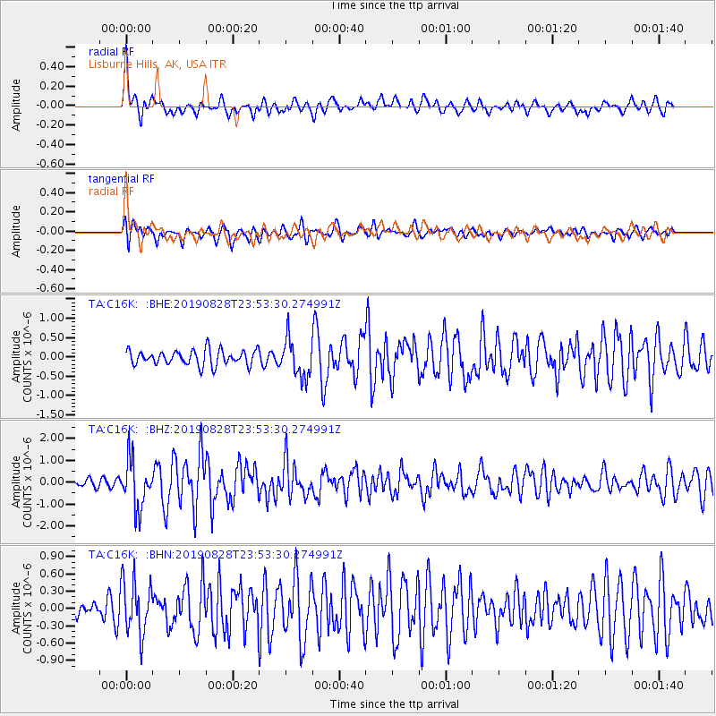
C16K Lisburne Hills, AK, USA - Earthquake Result Viewer
*The percent match for this event was below the threshold and hence no stack was calculated.
| Earthquake location: |
Hokkaido, Japan Region |
| Earthquake latitude/longitude: |
41.1/143.0 |
| Earthquake time(UTC): |
2019/08/28 (240) 23:46:39 GMT |
| Earthquake Depth: |
17 km |
| Earthquake Magnitude: |
6.1 Mww |
| Earthquake Catalog/Contributor: |
NEIC PDE/us |
|
| Network: |
TA USArray Transportable Network (new EarthScope stations) |
| Station: |
C16K Lisburne Hills, AK, USA |
| Lat/Lon: |
68.27 N/165.34 W |
| Elevation: |
102 m |
|
| Distance: |
38.6 deg |
| Az: |
27.944 deg |
| Baz: |
252.1 deg |
| Ray Param: |
$rayparam |
*The percent match for this event was below the threshold and hence was not used in the summary stack. |
|
| Radial Match: |
68.72492 % |
| Radial Bump: |
400 |
| Transverse Match: |
69.22914 % |
| Transverse Bump: |
400 |
| SOD ConfigId: |
19053131 |
| Insert Time: |
2019-09-11 23:59:35.141 +0000 |
| GWidth: |
2.5 |
| Max Bumps: |
400 |
| Tol: |
0.001 |
|
Signal To Noise
| Channel | StoN | STA | LTA |
| TA:C16K: :BHZ:20190828T23:53:30.274991Z | 6.35934 | 1.1012794E-6 | 1.731751E-7 |
| TA:C16K: :BHN:20190828T23:53:30.274991Z | 2.9248564 | 4.6704747E-7 | 1.5968219E-7 |
| TA:C16K: :BHE:20190828T23:53:30.274991Z | 2.567882 | 4.9753163E-7 | 1.9375175E-7 |
| Arrivals |
| Ps | |
| PpPs | |
| PsPs/PpSs | |


