You are here: Home > Network List > US - United States National Seismic Network Stations List
> Station WMOK Wichita Mountains, Oklahoma, USA > Earthquake Result Viewer
WMOK Wichita Mountains, Oklahoma, USA - Earthquake Result Viewer
*The percent match for this event was below the threshold and hence no stack was calculated.
| Earthquake location: |
Hokkaido, Japan Region |
| Earthquake latitude/longitude: |
41.1/143.0 |
| Earthquake time(UTC): |
2019/08/28 (240) 23:46:39 GMT |
| Earthquake Depth: |
17 km |
| Earthquake Magnitude: |
6.1 Mww |
| Earthquake Catalog/Contributor: |
NEIC PDE/us |
|
| Network: |
US United States National Seismic Network |
| Station: |
WMOK Wichita Mountains, Oklahoma, USA |
| Lat/Lon: |
34.74 N/98.78 W |
| Elevation: |
486 m |
|
| Distance: |
85.6 deg |
| Az: |
46.699 deg |
| Baz: |
318.079 deg |
| Ray Param: |
$rayparam |
*The percent match for this event was below the threshold and hence was not used in the summary stack. |
|
| Radial Match: |
76.72686 % |
| Radial Bump: |
400 |
| Transverse Match: |
57.35508 % |
| Transverse Bump: |
400 |
| SOD ConfigId: |
19053131 |
| Insert Time: |
2019-09-12 00:02:37.011 +0000 |
| GWidth: |
2.5 |
| Max Bumps: |
400 |
| Tol: |
0.001 |
|
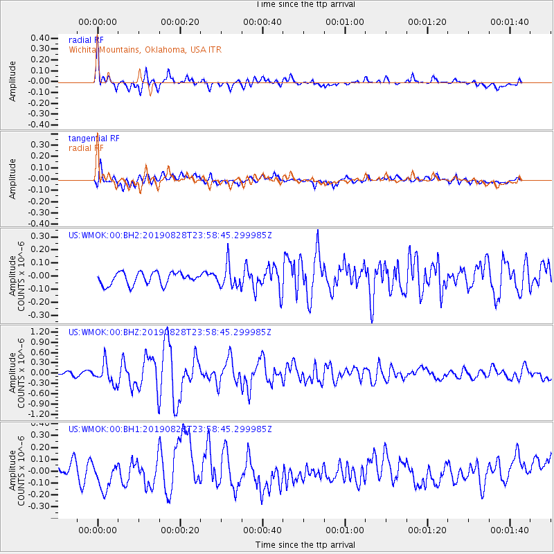
Signal To Noise
| Channel | StoN | STA | LTA |
| US:WMOK:00:BHZ:20190828T23:58:45.299985Z | 4.026448 | 3.0473802E-7 | 7.5684085E-8 |
| US:WMOK:00:BH1:20190828T23:58:45.299985Z | 1.2837561 | 9.663331E-8 | 7.527388E-8 |
| US:WMOK:00:BH2:20190828T23:58:45.299985Z | 1.921519 | 8.877245E-8 | 4.61991E-8 |
| Arrivals |
| Ps | |
| PpPs | |
| PsPs/PpSs | |


