You are here: Home > Network List > TA - USArray Transportable Network (new EarthScope stations) Stations List
> Station T21A Navajo Lake, Ignacio, CO, USA > Earthquake Result Viewer
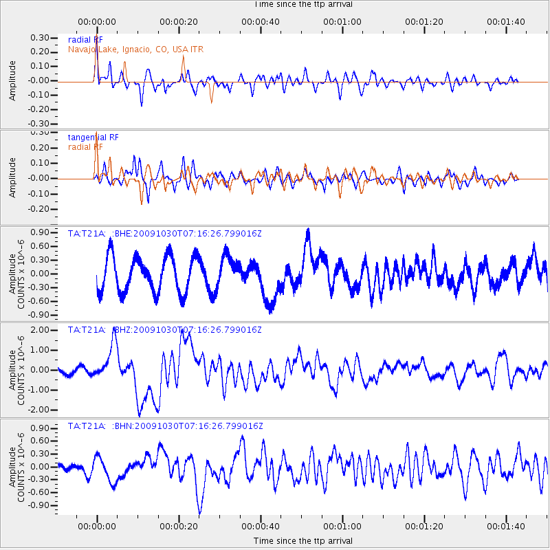
T21A Navajo Lake, Ignacio, CO, USA - Earthquake Result Viewer
*The percent match for this event was below the threshold and hence no stack was calculated.
| Earthquake location: |
Ryukyu Islands, Japan |
| Earthquake latitude/longitude: |
29.2/129.8 |
| Earthquake time(UTC): |
2009/10/30 (303) 07:03:39 GMT |
| Earthquake Depth: |
34 km |
| Earthquake Magnitude: |
6.3 MB, 6.8 MS, 6.8 MW, 6.8 MW |
| Earthquake Catalog/Contributor: |
WHDF/NEIC |
|
| Network: |
TA USArray Transportable Network (new EarthScope stations) |
| Station: |
T21A Navajo Lake, Ignacio, CO, USA |
| Lat/Lon: |
36.99 N/107.53 W |
| Elevation: |
2006 m |
|
| Distance: |
95.0 deg |
| Az: |
42.567 deg |
| Baz: |
312.392 deg |
| Ray Param: |
$rayparam |
*The percent match for this event was below the threshold and hence was not used in the summary stack. |
|
| Radial Match: |
61.62728 % |
| Radial Bump: |
400 |
| Transverse Match: |
47.657726 % |
| Transverse Bump: |
391 |
| SOD ConfigId: |
2622 |
| Insert Time: |
2010-03-07 03:48:59.018 +0000 |
| GWidth: |
2.5 |
| Max Bumps: |
400 |
| Tol: |
0.001 |
|
Signal To Noise
| Channel | StoN | STA | LTA |
| TA:T21A: :BHZ:20091030T07:16:26.799016Z | 4.4252067 | 9.701486E-7 | 2.1923236E-7 |
| TA:T21A: :BHN:20091030T07:16:26.799016Z | 2.1252177 | 2.9316087E-7 | 1.3794393E-7 |
| TA:T21A: :BHE:20091030T07:16:26.799016Z | 0.8724608 | 3.3593338E-7 | 3.8504123E-7 |
| Arrivals |
| Ps | |
| PpPs | |
| PsPs/PpSs | |


