You are here: Home > Network List > IW - Intermountain West Stations List
> Station PLID Pearl Lake, Idaho, USA > Earthquake Result Viewer
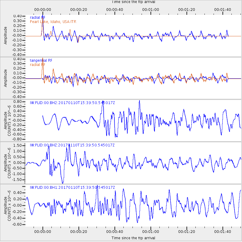
PLID Pearl Lake, Idaho, USA - Earthquake Result Viewer
*The percent match for this event was below the threshold and hence no stack was calculated.
| Earthquake location: |
Solomon Islands |
| Earthquake latitude/longitude: |
-10.1/161.0 |
| Earthquake time(UTC): |
2017/01/10 (010) 15:27:15 GMT |
| Earthquake Depth: |
28 km |
| Earthquake Magnitude: |
6.3 Mww |
| Earthquake Catalog/Contributor: |
NEIC PDE/us |
|
| Network: |
IW Intermountain West |
| Station: |
PLID Pearl Lake, Idaho, USA |
| Lat/Lon: |
45.09 N/116.00 W |
| Elevation: |
2164 m |
|
| Distance: |
92.2 deg |
| Az: |
44.715 deg |
| Baz: |
257.936 deg |
| Ray Param: |
$rayparam |
*The percent match for this event was below the threshold and hence was not used in the summary stack. |
|
| Radial Match: |
67.420586 % |
| Radial Bump: |
400 |
| Transverse Match: |
58.33822 % |
| Transverse Bump: |
400 |
| SOD ConfigId: |
1943534 |
| Insert Time: |
2017-01-24 15:29:05.974 +0000 |
| GWidth: |
2.5 |
| Max Bumps: |
400 |
| Tol: |
0.001 |
|
Signal To Noise
| Channel | StoN | STA | LTA |
| IW:PLID:00:BHZ:20170110T15:39:50.545017Z | 4.9919815 | 6.7227694E-7 | 1.3467137E-7 |
| IW:PLID:00:BH1:20170110T15:39:50.545017Z | 0.50557923 | 9.502858E-8 | 1.8795981E-7 |
| IW:PLID:00:BH2:20170110T15:39:50.545017Z | 2.5550199 | 3.519785E-7 | 1.377596E-7 |
| Arrivals |
| Ps | |
| PpPs | |
| PsPs/PpSs | |


