You are here: Home > Network List > IU - Global Seismograph Network (GSN - IRIS/USGS) Stations List
> Station GNI Garni, Armenia > Earthquake Result Viewer
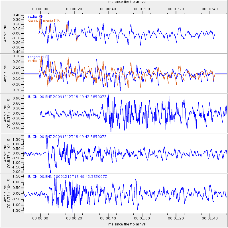
GNI Garni, Armenia - Earthquake Result Viewer
*The percent match for this event was below the threshold and hence no stack was calculated.
| Earthquake location: |
East Of Kuril Islands |
| Earthquake latitude/longitude: |
48.8/156.2 |
| Earthquake time(UTC): |
2009/12/12 (346) 18:38:45 GMT |
| Earthquake Depth: |
10 km |
| Earthquake Magnitude: |
5.6 MW, 5.3 MS, 5.3 MB, 5.6 MW |
| Earthquake Catalog/Contributor: |
WHDF/NEIC |
|
| Network: |
IU Global Seismograph Network (GSN - IRIS/USGS) |
| Station: |
GNI Garni, Armenia |
| Lat/Lon: |
40.15 N/44.74 E |
| Elevation: |
1609 m |
|
| Distance: |
72.7 deg |
| Az: |
311.661 deg |
| Baz: |
40.098 deg |
| Ray Param: |
$rayparam |
*The percent match for this event was below the threshold and hence was not used in the summary stack. |
|
| Radial Match: |
78.967865 % |
| Radial Bump: |
400 |
| Transverse Match: |
78.529655 % |
| Transverse Bump: |
400 |
| SOD ConfigId: |
1 |
| Insert Time: |
2010-02-19 01:23:24.382 +0000 |
| GWidth: |
2.5 |
| Max Bumps: |
400 |
| Tol: |
0.001 |
|
Signal To Noise
| Channel | StoN | STA | LTA |
| IU:GNI:00:BHZ:20091212T18:49:42.385007Z | 5.8314695 | 6.022486E-7 | 1.0327561E-7 |
| IU:GNI:00:BHN:20091212T18:49:42.385007Z | 1.741855 | 2.4801773E-7 | 1.4238712E-7 |
| IU:GNI:00:BHE:20091212T18:49:42.385007Z | 1.3200216 | 1.523693E-7 | 1.15429394E-7 |
| Arrivals |
| Ps | |
| PpPs | |
| PsPs/PpSs | |


