You are here: Home > Network List > US - United States National Seismic Network Stations List
> Station DUG Dugway, Tooele County, Utah, USA > Earthquake Result Viewer
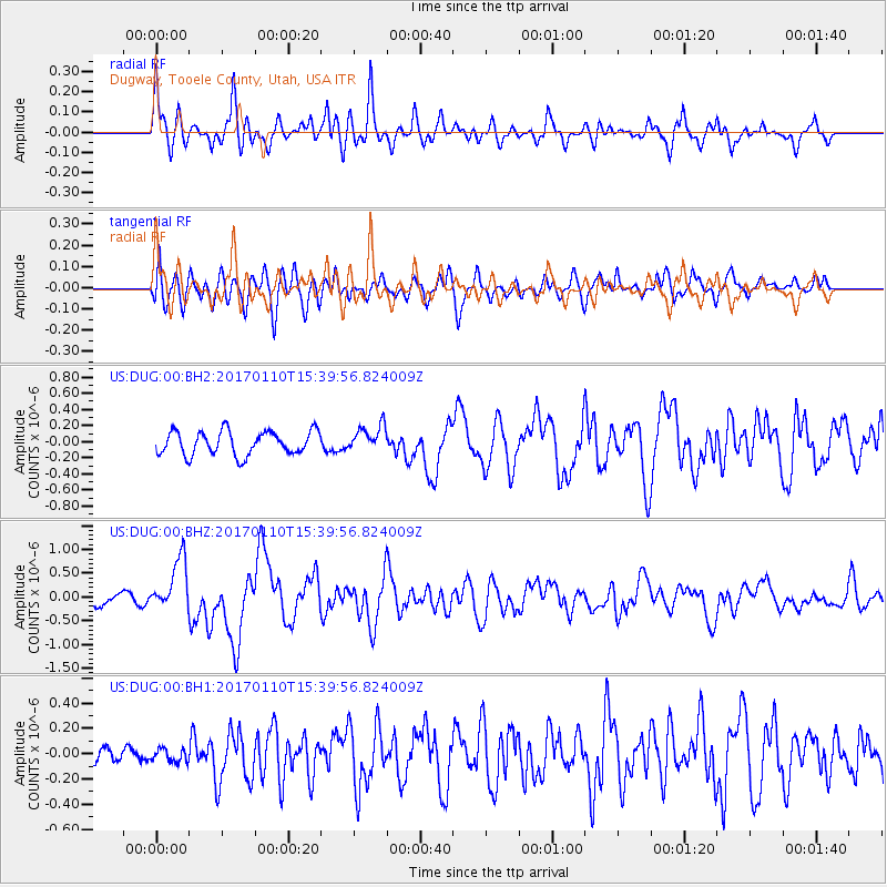
DUG Dugway, Tooele County, Utah, USA - Earthquake Result Viewer
*The percent match for this event was below the threshold and hence no stack was calculated.
| Earthquake location: |
Solomon Islands |
| Earthquake latitude/longitude: |
-10.1/161.0 |
| Earthquake time(UTC): |
2017/01/10 (010) 15:27:15 GMT |
| Earthquake Depth: |
28 km |
| Earthquake Magnitude: |
6.3 Mww |
| Earthquake Catalog/Contributor: |
NEIC PDE/us |
|
| Network: |
US United States National Seismic Network |
| Station: |
DUG Dugway, Tooele County, Utah, USA |
| Lat/Lon: |
40.19 N/112.81 W |
| Elevation: |
1477 m |
|
| Distance: |
93.5 deg |
| Az: |
49.972 deg |
| Baz: |
259.827 deg |
| Ray Param: |
$rayparam |
*The percent match for this event was below the threshold and hence was not used in the summary stack. |
|
| Radial Match: |
83.092125 % |
| Radial Bump: |
400 |
| Transverse Match: |
68.40014 % |
| Transverse Bump: |
400 |
| SOD ConfigId: |
1943534 |
| Insert Time: |
2017-01-24 15:29:24.023 +0000 |
| GWidth: |
2.5 |
| Max Bumps: |
400 |
| Tol: |
0.001 |
|
Signal To Noise
| Channel | StoN | STA | LTA |
| US:DUG:00:BHZ:20170110T15:39:56.824009Z | 3.4876988 | 5.5030915E-7 | 1.5778573E-7 |
| US:DUG:00:BH1:20170110T15:39:56.824009Z | 0.39360592 | 5.323448E-8 | 1.3524816E-7 |
| US:DUG:00:BH2:20170110T15:39:56.824009Z | 1.0801998 | 1.5978024E-7 | 1.4791729E-7 |
| Arrivals |
| Ps | |
| PpPs | |
| PsPs/PpSs | |


