You are here: Home > Network List > US - United States National Seismic Network Stations List
> Station NEW Newport, Washington, USA > Earthquake Result Viewer
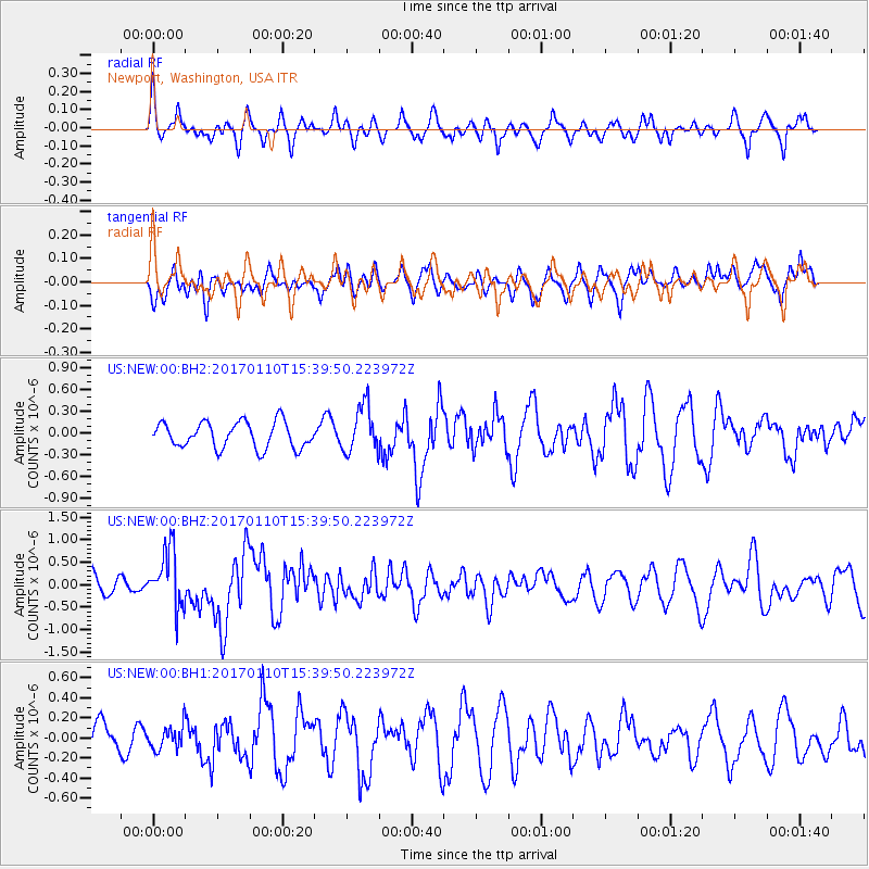
NEW Newport, Washington, USA - Earthquake Result Viewer
*The percent match for this event was below the threshold and hence no stack was calculated.
| Earthquake location: |
Solomon Islands |
| Earthquake latitude/longitude: |
-10.1/161.0 |
| Earthquake time(UTC): |
2017/01/10 (010) 15:27:15 GMT |
| Earthquake Depth: |
28 km |
| Earthquake Magnitude: |
6.3 Mww |
| Earthquake Catalog/Contributor: |
NEIC PDE/us |
|
| Network: |
US United States National Seismic Network |
| Station: |
NEW Newport, Washington, USA |
| Lat/Lon: |
48.26 N/117.12 W |
| Elevation: |
760 m |
|
| Distance: |
92.1 deg |
| Az: |
41.445 deg |
| Baz: |
257.246 deg |
| Ray Param: |
$rayparam |
*The percent match for this event was below the threshold and hence was not used in the summary stack. |
|
| Radial Match: |
55.752518 % |
| Radial Bump: |
389 |
| Transverse Match: |
48.02393 % |
| Transverse Bump: |
400 |
| SOD ConfigId: |
1943534 |
| Insert Time: |
2017-01-24 15:29:39.999 +0000 |
| GWidth: |
2.5 |
| Max Bumps: |
400 |
| Tol: |
0.001 |
|
Signal To Noise
| Channel | StoN | STA | LTA |
| US:NEW:00:BHZ:20170110T15:39:50.223972Z | 1.9758079 | 6.3567944E-7 | 3.2173142E-7 |
| US:NEW:00:BH1:20170110T15:39:50.223972Z | 0.45465857 | 1.14411414E-7 | 2.516425E-7 |
| US:NEW:00:BH2:20170110T15:39:50.223972Z | 1.8130032 | 3.2422219E-7 | 1.7883156E-7 |
| Arrivals |
| Ps | |
| PpPs | |
| PsPs/PpSs | |


