You are here: Home > Network List > TS - TERRAscope (Southern California Seismic Network) Stations List
> Station MLAC Mammoth Lakes, California, USA > Earthquake Result Viewer
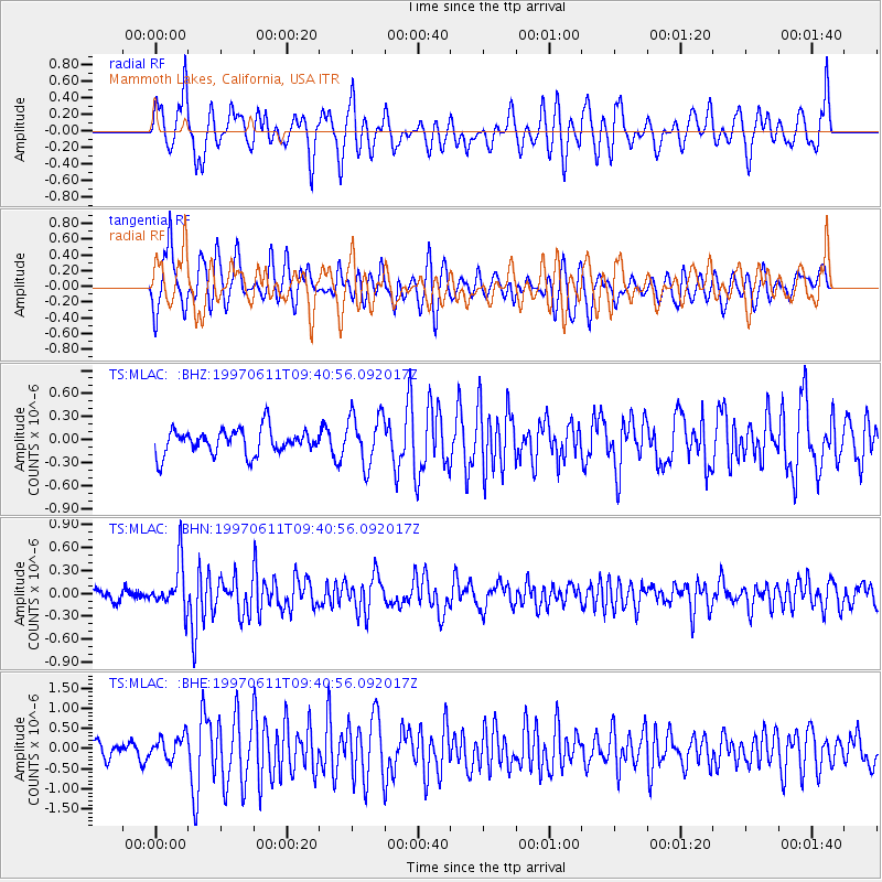
MLAC Mammoth Lakes, California, USA - Earthquake Result Viewer
*The percent match for this event was below the threshold and hence no stack was calculated.
| Earthquake location: |
South Of Fiji Islands |
| Earthquake latitude/longitude: |
-24.0/-177.5 |
| Earthquake time(UTC): |
1997/06/11 (162) 09:29:23 GMT |
| Earthquake Depth: |
164 km |
| Earthquake Magnitude: |
5.9 UNKNOWN, 5.4 MB, 5.5 MB |
| Earthquake Catalog/Contributor: |
WHDF/NEIC |
|
| Network: |
TS TERRAscope (Southern California Seismic Network) |
| Station: |
MLAC Mammoth Lakes, California, USA |
| Lat/Lon: |
37.63 N/118.83 W |
| Elevation: |
2170 m |
|
| Distance: |
82.4 deg |
| Az: |
43.172 deg |
| Baz: |
232.028 deg |
| Ray Param: |
$rayparam |
*The percent match for this event was below the threshold and hence was not used in the summary stack. |
|
| Radial Match: |
61.602158 % |
| Radial Bump: |
400 |
| Transverse Match: |
52.893288 % |
| Transverse Bump: |
400 |
| SOD ConfigId: |
4480 |
| Insert Time: |
2010-02-26 14:27:23.185 +0000 |
| GWidth: |
2.5 |
| Max Bumps: |
400 |
| Tol: |
0.001 |
|
Signal To Noise
| Channel | StoN | STA | LTA |
| TS:MLAC: :BHN:19970611T09:40:56.092017Z | 5.019835 | 3.1303696E-7 | 6.236001E-8 |
| TS:MLAC: :BHE:19970611T09:40:56.092017Z | 1.4254531 | 2.9595276E-7 | 2.0762012E-7 |
| TS:MLAC: :BHZ:19970611T09:40:56.092017Z | 2.019582 | 3.3115134E-7 | 1.6397024E-7 |
| Arrivals |
| Ps | |
| PpPs | |
| PsPs/PpSs | |


