You are here: Home > Network List > CN - Canadian National Seismograph Network Stations List
> Station INK INUVIK, NT > Earthquake Result Viewer
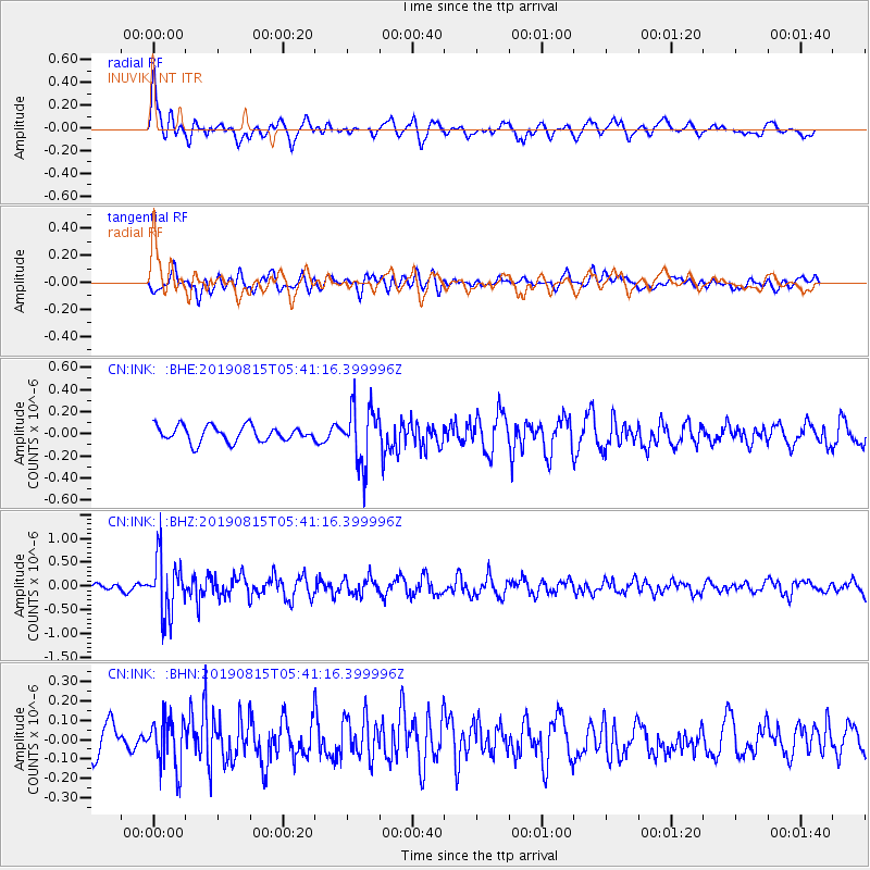
INK INUVIK, NT - Earthquake Result Viewer
*The percent match for this event was below the threshold and hence no stack was calculated.
| Earthquake location: |
Near East Coast Of Honshu, Japan |
| Earthquake latitude/longitude: |
40.8/141.2 |
| Earthquake time(UTC): |
2019/08/15 (227) 05:32:53 GMT |
| Earthquake Depth: |
86 km |
| Earthquake Magnitude: |
5.4 Mww |
| Earthquake Catalog/Contributor: |
NEIC PDE/us |
|
| Network: |
CN Canadian National Seismograph Network |
| Station: |
INK INUVIK, NT |
| Lat/Lon: |
68.31 N/133.53 W |
| Elevation: |
44 m |
|
| Distance: |
51.1 deg |
| Az: |
28.432 deg |
| Baz: |
283.644 deg |
| Ray Param: |
$rayparam |
*The percent match for this event was below the threshold and hence was not used in the summary stack. |
|
| Radial Match: |
67.205055 % |
| Radial Bump: |
400 |
| Transverse Match: |
63.057636 % |
| Transverse Bump: |
400 |
| SOD ConfigId: |
19053131 |
| Insert Time: |
2019-09-12 06:40:15.351 +0000 |
| GWidth: |
2.5 |
| Max Bumps: |
400 |
| Tol: |
0.001 |
|
Signal To Noise
| Channel | StoN | STA | LTA |
| CN:INK: :BHZ:20190815T05:41:16.399996Z | 8.135639 | 5.937143E-7 | 7.297697E-8 |
| CN:INK: :BHN:20190815T05:41:16.399996Z | 1.8137516 | 1.2612068E-7 | 6.953581E-8 |
| CN:INK: :BHE:20190815T05:41:16.399996Z | 3.733645 | 2.6265778E-7 | 7.034889E-8 |
| Arrivals |
| Ps | |
| PpPs | |
| PsPs/PpSs | |


