You are here: Home > Network List > TS - TERRAscope (Southern California Seismic Network) Stations List
> Station MLAC Mammoth Lakes, California, USA > Earthquake Result Viewer
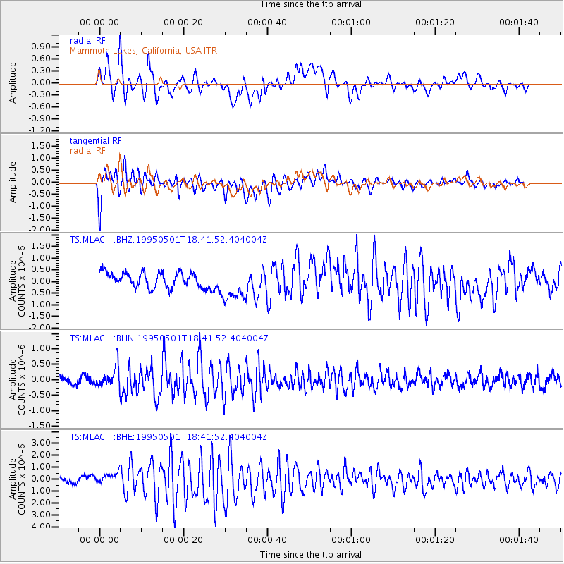
MLAC Mammoth Lakes, California, USA - Earthquake Result Viewer
*The percent match for this event was below the threshold and hence no stack was calculated.
| Earthquake location: |
Solomon Islands |
| Earthquake latitude/longitude: |
-10.6/161.4 |
| Earthquake time(UTC): |
1995/05/01 (121) 18:29:41 GMT |
| Earthquake Depth: |
94 km |
| Earthquake Magnitude: |
5.5 MB, 6.0 UNKNOWN, 5.8 MW |
| Earthquake Catalog/Contributor: |
WHDF/NEIC |
|
| Network: |
TS TERRAscope (Southern California Seismic Network) |
| Station: |
MLAC Mammoth Lakes, California, USA |
| Lat/Lon: |
37.63 N/118.83 W |
| Elevation: |
2170 m |
|
| Distance: |
88.5 deg |
| Az: |
51.412 deg |
| Baz: |
255.429 deg |
| Ray Param: |
$rayparam |
*The percent match for this event was below the threshold and hence was not used in the summary stack. |
|
| Radial Match: |
67.902954 % |
| Radial Bump: |
400 |
| Transverse Match: |
61.83355 % |
| Transverse Bump: |
400 |
| SOD ConfigId: |
4480 |
| Insert Time: |
2010-02-26 14:27:25.468 +0000 |
| GWidth: |
2.5 |
| Max Bumps: |
400 |
| Tol: |
0.001 |
|
Signal To Noise
| Channel | StoN | STA | LTA |
| TS:MLAC: :BHN:19950501T18:41:52.404004Z | 3.3392856 | 3.500707E-7 | 1.0483401E-7 |
| TS:MLAC: :BHE:19950501T18:41:52.404004Z | 1.9855083 | 5.35315E-7 | 2.6961106E-7 |
| TS:MLAC: :BHZ:19950501T18:41:52.404004Z | 2.505497 | 7.6151446E-7 | 3.039375E-7 |
| Arrivals |
| Ps | |
| PpPs | |
| PsPs/PpSs | |


