You are here: Home > Network List > TA - USArray Transportable Network (new EarthScope stations) Stations List
> Station C16K Lisburne Hills, AK, USA > Earthquake Result Viewer
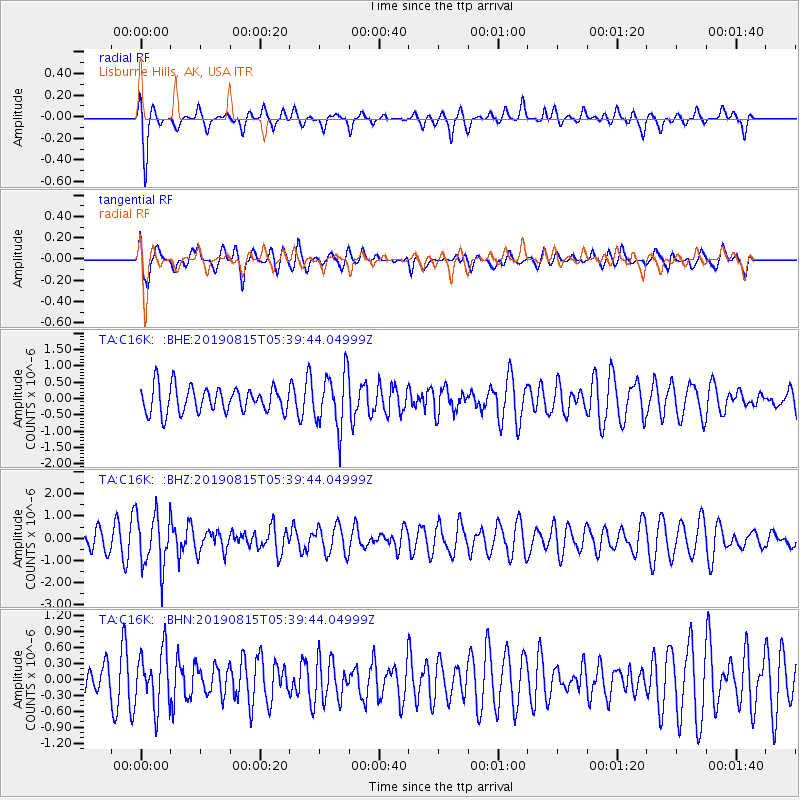
C16K Lisburne Hills, AK, USA - Earthquake Result Viewer
*The percent match for this event was below the threshold and hence no stack was calculated.
| Earthquake location: |
Near East Coast Of Honshu, Japan |
| Earthquake latitude/longitude: |
40.8/141.2 |
| Earthquake time(UTC): |
2019/08/15 (227) 05:32:53 GMT |
| Earthquake Depth: |
86 km |
| Earthquake Magnitude: |
5.4 Mww |
| Earthquake Catalog/Contributor: |
NEIC PDE/us |
|
| Network: |
TA USArray Transportable Network (new EarthScope stations) |
| Station: |
C16K Lisburne Hills, AK, USA |
| Lat/Lon: |
68.27 N/165.34 W |
| Elevation: |
102 m |
|
| Distance: |
39.4 deg |
| Az: |
28.104 deg |
| Baz: |
253.774 deg |
| Ray Param: |
$rayparam |
*The percent match for this event was below the threshold and hence was not used in the summary stack. |
|
| Radial Match: |
72.426125 % |
| Radial Bump: |
400 |
| Transverse Match: |
67.26644 % |
| Transverse Bump: |
400 |
| SOD ConfigId: |
19053131 |
| Insert Time: |
2019-09-12 06:45:14.690 +0000 |
| GWidth: |
2.5 |
| Max Bumps: |
400 |
| Tol: |
0.001 |
|
Signal To Noise
| Channel | StoN | STA | LTA |
| TA:C16K: :BHZ:20190815T05:39:44.04999Z | 2.587932 | 1.2113255E-6 | 4.6806696E-7 |
| TA:C16K: :BHN:20190815T05:39:44.04999Z | 1.7883306 | 5.247482E-7 | 2.9342908E-7 |
| TA:C16K: :BHE:20190815T05:39:44.04999Z | 2.1628816 | 8.4587464E-7 | 3.9108687E-7 |
| Arrivals |
| Ps | |
| PpPs | |
| PsPs/PpSs | |


