You are here: Home > Network List > TA - USArray Transportable Network (new EarthScope stations) Stations List
> Station D25K Kavik River, AK, USA > Earthquake Result Viewer
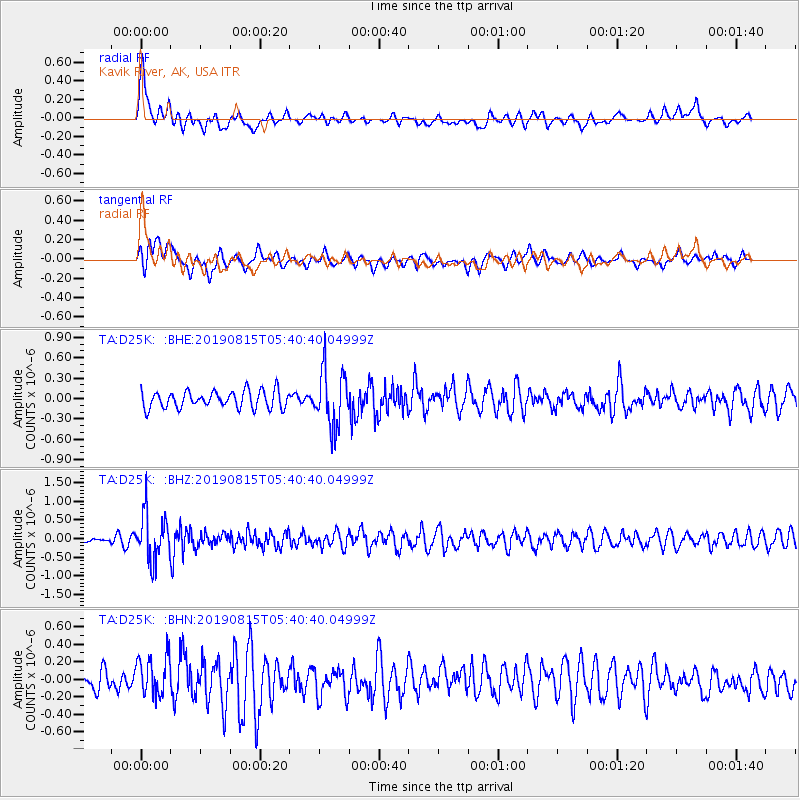
D25K Kavik River, AK, USA - Earthquake Result Viewer
*The percent match for this event was below the threshold and hence no stack was calculated.
| Earthquake location: |
Near East Coast Of Honshu, Japan |
| Earthquake latitude/longitude: |
40.8/141.2 |
| Earthquake time(UTC): |
2019/08/15 (227) 05:32:53 GMT |
| Earthquake Depth: |
86 km |
| Earthquake Magnitude: |
5.4 Mww |
| Earthquake Catalog/Contributor: |
NEIC PDE/us |
|
| Network: |
TA USArray Transportable Network (new EarthScope stations) |
| Station: |
D25K Kavik River, AK, USA |
| Lat/Lon: |
69.32 N/146.38 W |
| Elevation: |
770 m |
|
| Distance: |
46.3 deg |
| Az: |
27.901 deg |
| Baz: |
271.316 deg |
| Ray Param: |
$rayparam |
*The percent match for this event was below the threshold and hence was not used in the summary stack. |
|
| Radial Match: |
71.24762 % |
| Radial Bump: |
400 |
| Transverse Match: |
49.334465 % |
| Transverse Bump: |
358 |
| SOD ConfigId: |
19053131 |
| Insert Time: |
2019-09-12 06:45:23.244 +0000 |
| GWidth: |
2.5 |
| Max Bumps: |
400 |
| Tol: |
0.001 |
|
Signal To Noise
| Channel | StoN | STA | LTA |
| TA:D25K: :BHZ:20190815T05:40:40.04999Z | 7.3861017 | 6.20835E-7 | 8.405449E-8 |
| TA:D25K: :BHN:20190815T05:40:40.04999Z | 1.4336543 | 2.2745432E-7 | 1.5865353E-7 |
| TA:D25K: :BHE:20190815T05:40:40.04999Z | 3.3201845 | 4.1772878E-7 | 1.2581494E-7 |
| Arrivals |
| Ps | |
| PpPs | |
| PsPs/PpSs | |


