You are here: Home > Network List > G - GEOSCOPE Stations List
> Station NOUC Port Laguerre, New Caledonia > Earthquake Result Viewer
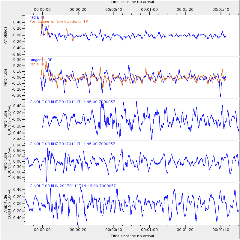
NOUC Port Laguerre, New Caledonia - Earthquake Result Viewer
*The percent match for this event was below the threshold and hence no stack was calculated.
| Earthquake location: |
South Of Mariana Islands |
| Earthquake latitude/longitude: |
12.2/141.1 |
| Earthquake time(UTC): |
2017/01/11 (011) 14:38:39 GMT |
| Earthquake Depth: |
10 km |
| Earthquake Magnitude: |
5.5 mb |
| Earthquake Catalog/Contributor: |
NEIC PDE/us |
|
| Network: |
G GEOSCOPE |
| Station: |
NOUC Port Laguerre, New Caledonia |
| Lat/Lon: |
22.10 S/166.30 E |
| Elevation: |
112 m |
|
| Distance: |
42.1 deg |
| Az: |
143.913 deg |
| Baz: |
321.618 deg |
| Ray Param: |
$rayparam |
*The percent match for this event was below the threshold and hence was not used in the summary stack. |
|
| Radial Match: |
51.754642 % |
| Radial Bump: |
400 |
| Transverse Match: |
58.32204 % |
| Transverse Bump: |
400 |
| SOD ConfigId: |
1943534 |
| Insert Time: |
2017-01-25 14:42:56.563 +0000 |
| GWidth: |
2.5 |
| Max Bumps: |
400 |
| Tol: |
0.001 |
|
Signal To Noise
| Channel | StoN | STA | LTA |
| G:NOUC:00:BHZ:20170111T14:46:00.700005Z | 3.4100301 | 4.1554605E-7 | 1.2185994E-7 |
| G:NOUC:00:BHN:20170111T14:46:00.700005Z | 1.0323104 | 1.5108007E-7 | 1.4635141E-7 |
| G:NOUC:00:BHE:20170111T14:46:00.700005Z | 2.789852 | 3.2042564E-7 | 1.1485399E-7 |
| Arrivals |
| Ps | |
| PpPs | |
| PsPs/PpSs | |


