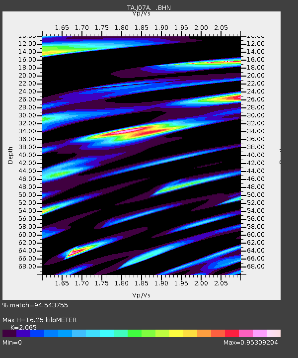
J07A Hines, OR, USA - Earthquake Result Viewer

Earthquake location: Fox Islands, Aleutian Islands
Earthquake latitude/longitude: 52.5/-168.0
Earthquake time(UTC): 2007/07/15 (196) 13:08:00 GMT
Earthquake Depth: 10 km
Earthquake Magnitude: 5.8 MB, 5.9 MS, 6.1 MW, 6.0 MW
Earthquake Catalog/Contributor: WHDF/NEIC
Network: TA USArray Transportable Network (new EarthScope stations)
Station: J07A Hines, OR, USA
Lat/Lon: 43.37 N/119.31 W
Elevation: 1273 m
Distance: 33.3 deg
Az: 86.027 deg
Baz: 303.201 deg
Ray Param: 0.07825791
Estimated Moho Depth: 16.25 km
Estimated Crust Vp/Vs: 2.07
Assumed Crust Vp: 6.279 km/s
Estimated Crust Vs: 3.04 km/s
Estimated Crust Poisson's Ratio: 0.35
Radial Match: 94.543755 %
Radial Bump: 400
Transverse Match: 86.84114 %
Transverse Bump: 400
SOD ConfigId: 2564
Insert Time: 2010-03-07 03:51:54.165 +0000
GWidth: 2.5
Max Bumps: 400
Tol: 0.001

Signal To Noise

ChannelStoNSTALTA
TA:J07A: :BHN:20070715T13:14:08.049014Z2.2844312.3299935E-71.0199447E-7
TA:J07A: :BHE:20070715T13:14:08.049014Z2.16354442.3773083E-71.0988027E-7
TA:J07A: :BHZ:20070715T13:14:08.049014Z6.29164364.6258714E-77.3524056E-8
Arrivals
Ps2.9 SECOND
PpPs7.4 SECOND
PsPs/PpSs10 SECOND