You are here: Home > Network List > TA - USArray Transportable Network (new EarthScope stations) Stations List
> Station P17K Kvichak River, AK, USA > Earthquake Result Viewer
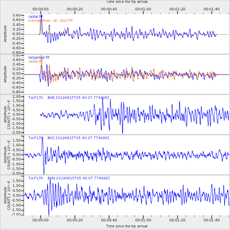
P17K Kvichak River, AK, USA - Earthquake Result Viewer
*The percent match for this event was below the threshold and hence no stack was calculated.
| Earthquake location: |
Near East Coast Of Honshu, Japan |
| Earthquake latitude/longitude: |
40.8/141.2 |
| Earthquake time(UTC): |
2019/08/15 (227) 05:32:53 GMT |
| Earthquake Depth: |
86 km |
| Earthquake Magnitude: |
5.4 Mww |
| Earthquake Catalog/Contributor: |
NEIC PDE/us |
|
| Network: |
TA USArray Transportable Network (new EarthScope stations) |
| Station: |
P17K Kvichak River, AK, USA |
| Lat/Lon: |
59.20 N/156.44 W |
| Elevation: |
91 m |
|
| Distance: |
42.3 deg |
| Az: |
42.64 deg |
| Baz: |
272.803 deg |
| Ray Param: |
$rayparam |
*The percent match for this event was below the threshold and hence was not used in the summary stack. |
|
| Radial Match: |
74.66623 % |
| Radial Bump: |
400 |
| Transverse Match: |
75.35256 % |
| Transverse Bump: |
400 |
| SOD ConfigId: |
19053131 |
| Insert Time: |
2019-09-12 06:46:48.076 +0000 |
| GWidth: |
2.5 |
| Max Bumps: |
400 |
| Tol: |
0.001 |
|
Signal To Noise
| Channel | StoN | STA | LTA |
| TA:P17K: :BHZ:20190815T05:40:07.774996Z | 7.3481526 | 8.601851E-7 | 1.1706141E-7 |
| TA:P17K: :BHN:20190815T05:40:07.774996Z | 3.8537505 | 6.515548E-7 | 1.6907032E-7 |
| TA:P17K: :BHE:20190815T05:40:07.774996Z | 2.804168 | 5.133635E-7 | 1.8307159E-7 |
| Arrivals |
| Ps | |
| PpPs | |
| PsPs/PpSs | |


