You are here: Home > Network List > US - United States National Seismic Network Stations List
> Station HAWA Hanford, Washington, USA > Earthquake Result Viewer
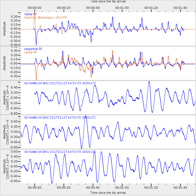
HAWA Hanford, Washington, USA - Earthquake Result Viewer
*The percent match for this event was below the threshold and hence no stack was calculated.
| Earthquake location: |
South Of Mariana Islands |
| Earthquake latitude/longitude: |
12.2/141.1 |
| Earthquake time(UTC): |
2017/01/11 (011) 14:38:39 GMT |
| Earthquake Depth: |
10 km |
| Earthquake Magnitude: |
5.5 mb |
| Earthquake Catalog/Contributor: |
NEIC PDE/us |
|
| Network: |
US United States National Seismic Network |
| Station: |
HAWA Hanford, Washington, USA |
| Lat/Lon: |
46.39 N/119.53 W |
| Elevation: |
364 m |
|
| Distance: |
87.6 deg |
| Az: |
43.114 deg |
| Baz: |
285.134 deg |
| Ray Param: |
$rayparam |
*The percent match for this event was below the threshold and hence was not used in the summary stack. |
|
| Radial Match: |
57.212948 % |
| Radial Bump: |
400 |
| Transverse Match: |
56.0737 % |
| Transverse Bump: |
291 |
| SOD ConfigId: |
1943534 |
| Insert Time: |
2017-01-25 14:44:26.844 +0000 |
| GWidth: |
2.5 |
| Max Bumps: |
400 |
| Tol: |
0.001 |
|
Signal To Noise
| Channel | StoN | STA | LTA |
| US:HAWA:00:BHZ:20170111T14:50:55.900017Z | 0.86131686 | 2.1250375E-7 | 2.467196E-7 |
| US:HAWA:00:BH1:20170111T14:50:55.900017Z | 0.7762933 | 1.0980399E-7 | 1.4144653E-7 |
| US:HAWA:00:BH2:20170111T14:50:55.900017Z | 1.8016367 | 2.8144146E-7 | 1.5621433E-7 |
| Arrivals |
| Ps | |
| PpPs | |
| PsPs/PpSs | |


