You are here: Home > Network List > UW - Pacific Northwest Regional Seismic Network Stations List
> Station LEBA Lebam, WA, USA > Earthquake Result Viewer
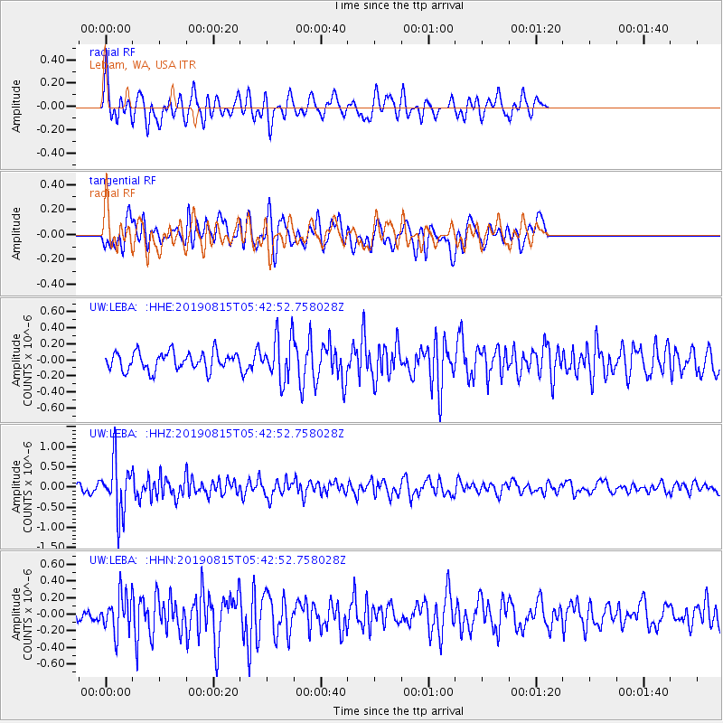
LEBA Lebam, WA, USA - Earthquake Result Viewer
*The percent match for this event was below the threshold and hence no stack was calculated.
| Earthquake location: |
Near East Coast Of Honshu, Japan |
| Earthquake latitude/longitude: |
40.8/141.2 |
| Earthquake time(UTC): |
2019/08/15 (227) 05:32:53 GMT |
| Earthquake Depth: |
86 km |
| Earthquake Magnitude: |
5.4 Mww |
| Earthquake Catalog/Contributor: |
NEIC PDE/us |
|
| Network: |
UW Pacific Northwest Regional Seismic Network |
| Station: |
LEBA Lebam, WA, USA |
| Lat/Lon: |
46.55 N/123.56 W |
| Elevation: |
73 m |
|
| Distance: |
64.9 deg |
| Az: |
49.369 deg |
| Baz: |
303.447 deg |
| Ray Param: |
$rayparam |
*The percent match for this event was below the threshold and hence was not used in the summary stack. |
|
| Radial Match: |
65.070045 % |
| Radial Bump: |
400 |
| Transverse Match: |
57.935314 % |
| Transverse Bump: |
400 |
| SOD ConfigId: |
19053131 |
| Insert Time: |
2019-09-12 06:48:50.497 +0000 |
| GWidth: |
2.5 |
| Max Bumps: |
400 |
| Tol: |
0.001 |
|
Signal To Noise
| Channel | StoN | STA | LTA |
| UW:LEBA: :HHZ:20190815T05:42:52.758028Z | 6.066591 | 6.473934E-7 | 1.0671454E-7 |
| UW:LEBA: :HHN:20190815T05:42:52.758028Z | 2.2052557 | 2.296994E-7 | 1.0415997E-7 |
| UW:LEBA: :HHE:20190815T05:42:52.758028Z | 2.4062743 | 2.6840283E-7 | 1.115429E-7 |
| Arrivals |
| Ps | |
| PpPs | |
| PsPs/PpSs | |


