You are here: Home > Network List > LD - Lamont-Doherty Cooperative Seismographic Network Stations List
> Station MVL Millersville University, PA > Earthquake Result Viewer
MVL Millersville University, PA - Earthquake Result Viewer

| Earthquake location: |
Off Coast Of Oregon |
| Earthquake latitude/longitude: |
43.6/-127.8 |
| Earthquake time(UTC): |
2019/08/29 (241) 15:08:00 GMT |
| Earthquake Depth: |
12 km |
| Earthquake Magnitude: |
6.4 Mi |
| Earthquake Catalog/Contributor: |
NEIC PDE/at |
|
| Network: |
LD Lamont-Doherty Cooperative Seismographic Network |
| Station: |
MVL Millersville University, PA |
| Lat/Lon: |
40.00 N/76.35 W |
| Elevation: |
91 m |
|
| Distance: |
38.0 deg |
| Az: |
77.259 deg |
| Baz: |
292.726 deg |
| Ray Param: |
0.075815596 |
| Estimated Moho Depth: |
46.0 km |
| Estimated Crust Vp/Vs: |
1.66 |
| Assumed Crust Vp: |
6.419 km/s |
| Estimated Crust Vs: |
3.873 km/s |
| Estimated Crust Poisson's Ratio: |
0.21 |
|
| Radial Match: |
94.02879 % |
| Radial Bump: |
168 |
| Transverse Match: |
73.65752 % |
| Transverse Bump: |
312 |
| SOD ConfigId: |
19053131 |
| Insert Time: |
2019-09-12 15:13:08.593 +0000 |
| GWidth: |
2.5 |
| Max Bumps: |
400 |
| Tol: |
0.001 |
|
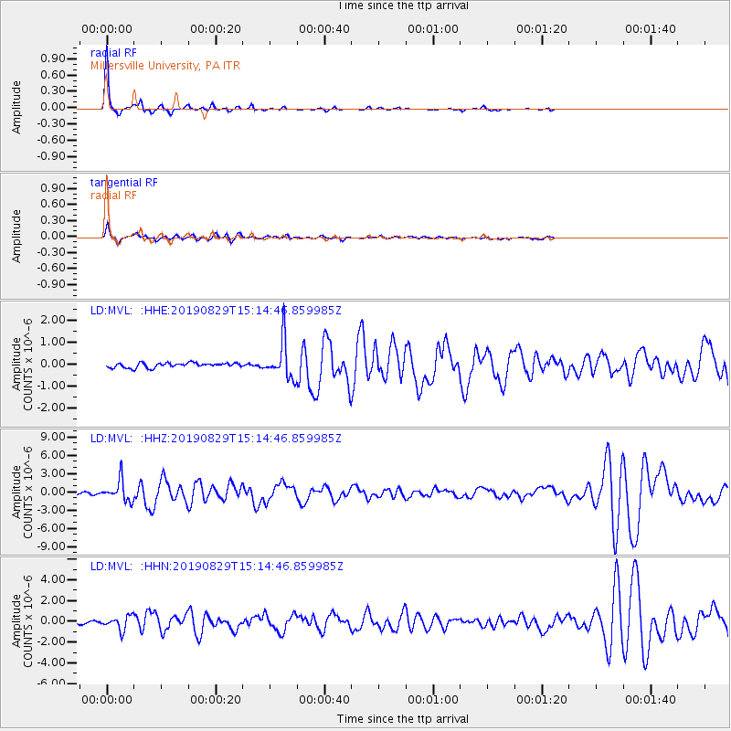
Signal To Noise
| Channel | StoN | STA | LTA |
| LD:MVL: :HHZ:20190829T15:14:46.859985Z | 9.412834 | 1.7557081E-6 | 1.865228E-7 |
| LD:MVL: :HHN:20190829T15:14:46.859985Z | 4.150416 | 6.78729E-7 | 1.6353276E-7 |
| LD:MVL: :HHE:20190829T15:14:46.859985Z | 7.9455137 | 8.655113E-7 | 1.0893082E-7 |
| Arrivals |
| Ps | 5.1 SECOND |
| PpPs | 18 SECOND |
| PsPs/PpSs | 23 SECOND |


