You are here: Home > Network List > TA - USArray Transportable Network (new EarthScope stations) Stations List
> Station C16K Lisburne Hills, AK, USA > Earthquake Result Viewer
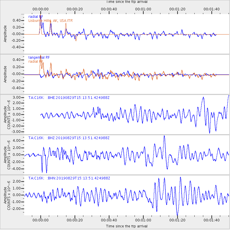
C16K Lisburne Hills, AK, USA - Earthquake Result Viewer
*The percent match for this event was below the threshold and hence no stack was calculated.
| Earthquake location: |
Off Coast Of Oregon |
| Earthquake latitude/longitude: |
43.6/-127.8 |
| Earthquake time(UTC): |
2019/08/29 (241) 15:08:00 GMT |
| Earthquake Depth: |
12 km |
| Earthquake Magnitude: |
6.4 Mi |
| Earthquake Catalog/Contributor: |
NEIC PDE/at |
|
| Network: |
TA USArray Transportable Network (new EarthScope stations) |
| Station: |
C16K Lisburne Hills, AK, USA |
| Lat/Lon: |
68.27 N/165.34 W |
| Elevation: |
102 m |
|
| Distance: |
31.6 deg |
| Az: |
334.279 deg |
| Baz: |
122.137 deg |
| Ray Param: |
$rayparam |
*The percent match for this event was below the threshold and hence was not used in the summary stack. |
|
| Radial Match: |
69.72151 % |
| Radial Bump: |
400 |
| Transverse Match: |
54.50363 % |
| Transverse Bump: |
400 |
| SOD ConfigId: |
19053131 |
| Insert Time: |
2019-09-12 15:15:26.129 +0000 |
| GWidth: |
2.5 |
| Max Bumps: |
400 |
| Tol: |
0.001 |
|
Signal To Noise
| Channel | StoN | STA | LTA |
| TA:C16K: :BHZ:20190829T15:13:51.424988Z | 6.063986 | 2.0597893E-6 | 3.3967578E-7 |
| TA:C16K: :BHN:20190829T15:13:51.424988Z | 1.7094843 | 4.143867E-7 | 2.424045E-7 |
| TA:C16K: :BHE:20190829T15:13:51.424988Z | 2.3446565 | 6.8387175E-7 | 2.916725E-7 |
| Arrivals |
| Ps | |
| PpPs | |
| PsPs/PpSs | |


