You are here: Home > Network List > TA - USArray Transportable Network (new EarthScope stations) Stations List
> Station B18K Kokolik River, AK, USA > Earthquake Result Viewer
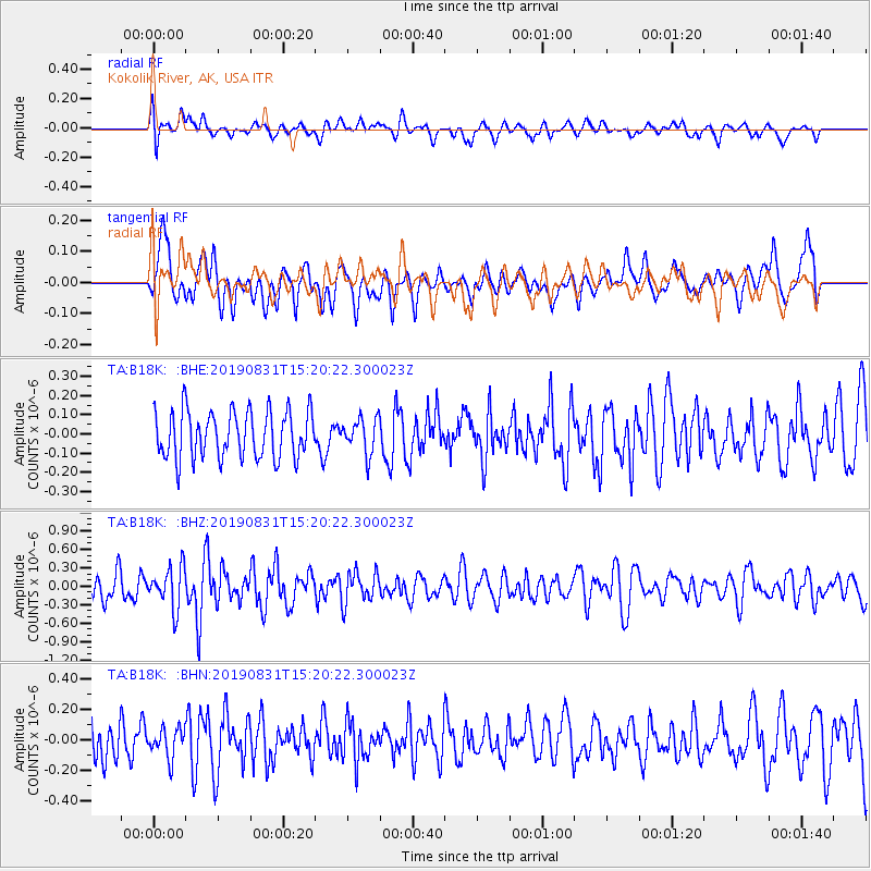
B18K Kokolik River, AK, USA - Earthquake Result Viewer
*The percent match for this event was below the threshold and hence no stack was calculated.
| Earthquake location: |
Myanmar |
| Earthquake latitude/longitude: |
22.7/95.5 |
| Earthquake time(UTC): |
2019/08/31 (243) 15:09:22 GMT |
| Earthquake Depth: |
10 km |
| Earthquake Magnitude: |
5.5 Mww |
| Earthquake Catalog/Contributor: |
NEIC PDE/us |
|
| Network: |
TA USArray Transportable Network (new EarthScope stations) |
| Station: |
B18K Kokolik River, AK, USA |
| Lat/Lon: |
69.36 N/161.80 W |
| Elevation: |
222 m |
|
| Distance: |
73.3 deg |
| Az: |
21.17 deg |
| Baz: |
289.88 deg |
| Ray Param: |
$rayparam |
*The percent match for this event was below the threshold and hence was not used in the summary stack. |
|
| Radial Match: |
55.71685 % |
| Radial Bump: |
400 |
| Transverse Match: |
57.571533 % |
| Transverse Bump: |
400 |
| SOD ConfigId: |
19053131 |
| Insert Time: |
2019-09-14 15:15:52.604 +0000 |
| GWidth: |
2.5 |
| Max Bumps: |
400 |
| Tol: |
0.001 |
|
Signal To Noise
| Channel | StoN | STA | LTA |
| TA:B18K: :BHZ:20190831T15:20:22.300023Z | 1.8113842 | 3.3393664E-7 | 1.8435439E-7 |
| TA:B18K: :BHN:20190831T15:20:22.300023Z | 0.6787692 | 9.526006E-8 | 1.4034235E-7 |
| TA:B18K: :BHE:20190831T15:20:22.300023Z | 0.7285915 | 9.00076E-8 | 1.2353644E-7 |
| Arrivals |
| Ps | |
| PpPs | |
| PsPs/PpSs | |


