You are here: Home > Network List > TA - USArray Transportable Network (new EarthScope stations) Stations List
> Station E20K Nigu River, AK, USA > Earthquake Result Viewer
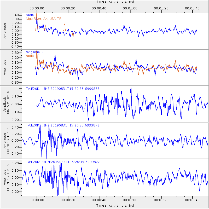
E20K Nigu River, AK, USA - Earthquake Result Viewer
*The percent match for this event was below the threshold and hence no stack was calculated.
| Earthquake location: |
Myanmar |
| Earthquake latitude/longitude: |
22.7/95.5 |
| Earthquake time(UTC): |
2019/08/31 (243) 15:09:22 GMT |
| Earthquake Depth: |
10 km |
| Earthquake Magnitude: |
5.5 Mww |
| Earthquake Catalog/Contributor: |
NEIC PDE/us |
|
| Network: |
TA USArray Transportable Network (new EarthScope stations) |
| Station: |
E20K Nigu River, AK, USA |
| Lat/Lon: |
68.26 N/156.19 W |
| Elevation: |
866 m |
|
| Distance: |
75.6 deg |
| Az: |
21.424 deg |
| Baz: |
295.178 deg |
| Ray Param: |
$rayparam |
*The percent match for this event was below the threshold and hence was not used in the summary stack. |
|
| Radial Match: |
53.584686 % |
| Radial Bump: |
400 |
| Transverse Match: |
57.743847 % |
| Transverse Bump: |
400 |
| SOD ConfigId: |
19053131 |
| Insert Time: |
2019-09-14 15:16:05.785 +0000 |
| GWidth: |
2.5 |
| Max Bumps: |
400 |
| Tol: |
0.001 |
|
Signal To Noise
| Channel | StoN | STA | LTA |
| TA:E20K: :BHZ:20190831T15:20:35.699987Z | 2.4256494 | 2.2604212E-7 | 9.3188284E-8 |
| TA:E20K: :BHN:20190831T15:20:35.699987Z | 1.8061514 | 9.1942255E-8 | 5.0905065E-8 |
| TA:E20K: :BHE:20190831T15:20:35.699987Z | 2.3989122 | 8.424276E-8 | 3.511707E-8 |
| Arrivals |
| Ps | |
| PpPs | |
| PsPs/PpSs | |


